Best hiking trails in Mörbylånga

Mörbylånga

Naturkartan samlar de vandringslederna i Mörbylånga som är populärast bland våra användare.

Images

Map

72 Best hiking trails in Mörbylånga

Hiking

Gösslunda path

  • Municipality: Mörbylånga
  • 6921.60 km away from you
  • 7.0 km

Gösslunda path is a 7 km long hiking trail that starts and ends at the parking lot opposite the entrance to Gösslunda village. The trail is marked with stone cairns that show you the way. Gösslundapath is relatively easy with mostly low-growing vegetation.…

Hiking

Bårby Källa hiking path

  • Municipality: Mörbylånga
  • 6920.22 km away from you
  • 6.0 km

At Bårby Källa there are two hiking trails, one of 1.8 km and one of 6 km, which take you out into a varied Alvar landscape. The hiking trail starts from the parking lot at Möckelmossen, on the south side of the road between Resmo and Stenåsa. The trail is…

Hiking

Signature trail - Mörbylångaleden Stage 2

  • Municipality: Mörbylånga
  • 6911.16 km away from you
  • 18.0 km
  • Difficulty: Blue

Linné Station, Skogsby - Mörbylånga TRAIL DESCRIPTION Accompanied by stunning views, this stage takes you along the coast to Mörbylånga. You pass through the lush, bird-rich Vickleby Forest and continue along the Kalmarsund past Haga Park. You follow the be…

Hiking

Signature trail - Mörbylångaleden Stage 4

  • Municipality: Mörbylånga
  • 6919.95 km away from you
  • 19.5 km
  • Difficulty: Blue

Kastlösa - Seby Läge TRAIL DESCRIPTION Stage 4 largely follows a route where the Öland railway ran until 1961. Between Kastlösa and Skärlöv it is easy to get around, even with a bicycle or pram. South of Skärlöv and up to Mellby the trail is more difficult,…

Hiking

Nunnedalen

  • Municipality: Mörbylånga
  • 4.0 km

Nunnedalen is located just south of Vickleby and is a narrow strip of deciduous forest on the edge of the western landborgen. In spring the ground here is covered with blue, white and yellow daisies. There are also spring bulbs and several species of evenin…

Hiking

Signature trail - Mörbylångaleden Stage 3

  • Municipality: Mörbylånga
  • 6912.76 km away from you
  • 13.5 km
  • Difficulty: Green

Mörbylånga - Kastlösa TRAIL DESCRIPTIONThe stage largely follows the fertile agricultural landscape and coastline of the Mörbylånga valley before heading out towards the alvar. You follow mostly paved road and shorter stretches of gravel road. At the coast…

Hiking

SIGNATURE TRAIL ÖLAND: MÖRBYLÅNGALEDEN STAGE 1

  • Municipality: Mörbylånga
  • 6910.20 km away from you
  • 18.0 km
  • Difficulty: Green

TRAIL DESCRIPTION At this stage, you will initially experience Kalmarsund, Ölandsbron and the area surrounding Färjestaden. Rural line villages, the leafy Mittlandsskogen, arable land, meadows and the outskirts of the alvar contribute to varied views. Stage…

Hiking

Mittlandsleden Gråborg -Jordtorpsåsen

  • Municipality: Mörbylånga
  • 6913.35 km away from you
  • 4.3 km

This part of the Mittlandsleden takes you between Jordtorpsåsen nature reserve and Gråborg. The route consists of different parts that are also good for hiking as circular loops. The western part starts at the Jordtorpsåsen nature reserve and can be walked…

Hiking

Beijershamn to Svansholmarna

  • Municipality: Mörbylånga
  • 6909.51 km away from you
  • 5.5 km

Beijershamn is one of the most important bird sites on Öland. It started with a pier construction in the mid-19th century that would result in an important harbour. That did not happen. Due to a faulty construction, the harbour quickly closed. Over time, th…

Hiking

Signature trail - Mörbylångaleden Stage 5

  • Municipality: Mörbylånga
  • 6931.79 km away from you
  • 14.5 km
  • Difficulty: Blue

Seby läge- Ottenby Hostel DIRECTIONS The final stage of the Mörbylångeden trail runs alternately across lake areas and along village streets, on the old railway embankment and through terraced villages. HRH Crown Princess Victoria walked this stage during h…

Hiking

Dröstorp vandringsled

  • Municipality: Mörbylånga
  • 6918.99 km away from you
  • 5.9 km

Hiking trail in Dröstorp nature reserve. Parking spaces are available in Skarpa Alby and Ekelunda. Along an alvar road from Skarpa Alby, you go out on the alvar to Dröstorp's deserted village, along the trail there are several exciting places to visit, such…

Hiking

Millerstone

  • Municipality: Mörbylånga
  • 6922.49 km away from you
  • 7.2 km

Millersten is a trail that is partly shared with the trail to Tingstad chips. Starting from the Penåsa car park, you follow the blue-marked posts on your hike across the alvar. You can choose to walk a 7.2 km loop starting from the car park/bank, or in comb…

Hiking

The great Alvar tour

  • Municipality: Mörbylånga
  • 6913.90 km away from you
  • 13.0 km
  • Difficulty: Blue

Karlevi - Frösslunda - Stenåsavägen The trail follows an old road across the alvar. It is not prepared but runs over existing land, which means that the road is of a very simple standard. If you bring a bicycle, it may need to be guided in places. After sno…

Hiking

Penåsa Ödeby

  • Municipality: Mörbylånga
  • 6922.90 km away from you
  • 2.0 km

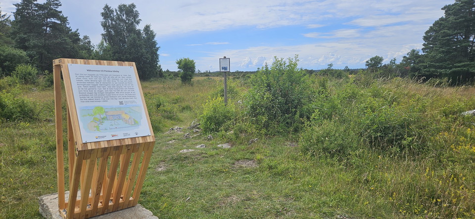
From Penåsa rest area you can hike a loop of about 2 km that goes in a south-easterly direction into Bjärby nature reserve to Penåsa desert village. The trail is marked with blue arrows. The path is narrow with some tree roots that are shallow and stone wal…

Hiking

Mittlandsleden Gråborg-Ismantorps borg

  • Municipality: Mörbylånga
  • 6914.50 km away from you
  • 15.0 km

The 50 kilometer long Mittlandsleden offers a scenic hike. Discover exciting ancient remains, beautiful village environments and interesting plants and insects. The trail goes through terrain where it is difficult to get around with a pram and wheelchair. I…

Best hiking trails in Mörbylånga

Naturkartan samlar de vandringslederna i Mörbylånga som är populärast bland våra användare.

Naturkartan

Open this in the app