Archaeological

Jönköpings län

Images

Map

79 Archaeological

Archaeological

Åsenhöga ödekyrkogård

  • Municipality: Gnosjö
  • 6728.39 km away from you

West of Åsenhöga church is the parish's old churchyard. When today's neoclassical church was built in 1857, the old wooden church was demolished and the churchyard was abandoned. During the 20th century, the cemetery has been carefully restored. The atmosph…

Archaeological

Avstickare Käringens kammare

  • Municipality: Vetlanda
  • 6808.01 km away from you
  • 0.1 km

A detour of 100 meters (one way) to a dam. Forest path. Käringen's chamber is a waterfall with a drop of eight meters. Once upon a time there was a sawmill, knitting mill and grinder here.

Archaeological

Gruvrundan, avstickare till Kleva gruva

  • Municipality: Vetlanda
  • 6801.80 km away from you
  • 2.0 km

At Kleva Mine, you'll be reminded of the hard work that goes into reaching the heart of the earth to collect treasure. Mine walks, treasure hunts, gold panning and climbing are examples of the different activities on offer for the whole family. Three centur…

Archaeological

Höga rör

  • Municipality: Gnosjö
  • 6739.35 km away from you

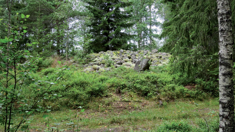
On the crest of a small moraine ridge south of Lake Flaten, between Storån and Store mosse, there are several square stone circles, probably from the Middle Iron Age, 200-600 AD. They are not definitely graves, but may also have served as territory or borde…

Archaeological

Brödrahalla runsten

  • Municipality: Gislaved
  • 6732.50 km away from you

Brödrahalla is located in a birch grove and has been identified as the old courthouse of Västbo district. On the site there are several erected stones from different eras, including a rune stone from the 10th or 11th century. The rune stone is erected a few…

Archaeological

Katrineholms slott (ruin)

  • Municipality: Aneby
  • 6758.39 km away from you

The place has had several different names over the years. The first known owner of Horsnäs was Jon Dansson (Bååt). This was in the early 14th century. He was married to Bo Jonsson Grip's mother in her second marriage. It is therefore likely that Bo Jonsson…

Archaeological

Sibbestenen

  • Municipality: Sävsjö
  • 6776.15 km away from you

Vikingen Olof reste stenen över sin son Sibbe som hade dött i England, troligtvis på en vikingafärd. Legenden säger att det ligger en jätte begravd intill stenen i en kopparkista. Intill ligger två stora gravfält från järnåldern och nyligen funna skålgropar…

Archaeological

Stora Ryet, fossil farmlands

  • Municipality: Värnamo
  • 6753.02 km away from you

100 years ago, the landscape around you consisted of large cleared and cultivated agricultural lands. These are now abandoned and called fossil farmlands. The remains today are stone walls and cairns, and they act as small biotopes, important habitats for m…

Archaeological

Häradsvägen

  • Municipality: Sävsjö
  • 6770.10 km away from you
  • 20.0 km
  • Difficulty: Green

Sävsjö Häradsväg between Vallsjö and Norra Ljunga is part of the history of Njudung. The road stretch of just under 20 kilometres showcases Småland at its very best. The route passes lakes, forests, fields and meadows. Halfway along the road lies the town o…

Archaeological

Backstugan, Sandbäcken

  • Municipality: Mullsjö
  • 6706.93 km away from you

Sand creek, baking shed If you take a short detour, about 360 meters round trip, you will come to a well-preserved hut. On the way you pass a hollow way. A hut is a simple little cottage built on open ground. The person who built and lived in the hut was ca…

Archaeological

Ryfors, Smedjan

  • Municipality: Mullsjö
  • 6703.63 km away from you

Ryfors smithy (rest area) At Hammarbron there is a group of buildings. The white house was the laundry. It was also used as a hot bathhouse and sauna. Next to it is Ryfors Upper Power Station from 1910. In 1742, privileges were obtained for a bar iron hamme…

Archaeological

Sankt Sigfrids källa

  • Municipality: Sävsjö
  • 6779.63 km away from you

Along Sävsjö häradsväg, near Vallsjö old church, there is a spring named after Saint Sigfrid. Can you see the small pits that are said to be marks of his knees? About the bowl pits in the now moss-covered stone, legend has it that they are marks of St. Sigf…

Archaeological

Galgabacken

  • Municipality: Sävsjö
  • 6772.00 km away from you

Galgabacken is a place just outside Komstad that was used as an execution site in the latter half of the 18th century. If you are interested in reading more about the history of the site, visit the website visitsavsjo.se - Galgabacken - Sävsjö municipality

Archaeological

Gravfält Norra Ljunga

  • Municipality: Sävsjö
  • 6772.31 km away from you

Burial grounds that were probably used as far back as the Late Iron Age. There are burial mounds, tridents, stone circles and doom rings. Most of the at least 100 graves and stone circles here are difficult to distinguish, but some are clearly visible. For…

Archaeological

Vallsjös gamla runsten

  • Municipality: Sävsjö
  • 6779.54 km away from you

Beautifully situated on top of the hill on Vallsjö meadow stands an old rune stone with the text "Väsäte and Ivar and Sylva, brothers three made bridge, this and put stone, this after Tjälve, father his". The different locations of the rune stone Originally…

Naturkartan

Open this in the app