New!

Now you can share photos on Naturkartan! 📸

Read more

Best hiking trails in Gagnef

Gagnef

Naturkartan samlar de vandringslederna i Gagnef som är populärast bland våra användare.

Images

Map

30 Best hiking trails in Gagnef

Hiking

Fäbodledsområde 3 Gröngubbens leder

  • Municipality: Gagnef
  • 6631.86 km away from you
  • 40.0 km

Friluftsfrämjandet in Gagnef has a unique hiking trail system consisting of 480 km of trails in a network covering the entire municipality. The purpose of the trails is to support outdoor recreation and preserve the centuries-old cultural trails. They are m…

Hiking

Änjansdalen runt

  • Municipality: Gagnef
  • 6630.73 km away from you
  • 3.3 km
  • Difficulty: Blue

In Änjansdalen you can see the natural result of both the passage of time and how running water can shape the landscape. For millennia, the river that runs through Änjansdalen has shaped the fine material deposited when the ice sheet melted. A hiking trail…

Hiking

Flotarleden

  • Municipality: Gagnef
  • 6604.33 km away from you
  • 13.5 km

The hiking trail runs between the forest lake Ekfänn and the Västerdal River and is 13.5 km long. It received a major boost that was completed in 2022. The trail comes out just upstream from Fänforsen in Västerdalälven. Along the trail at the dams there is…

Hiking

Kvarnaleden

  • Municipality: Gagnef
  • 6612.49 km away from you
  • 7.3 km
  • Difficulty: Green

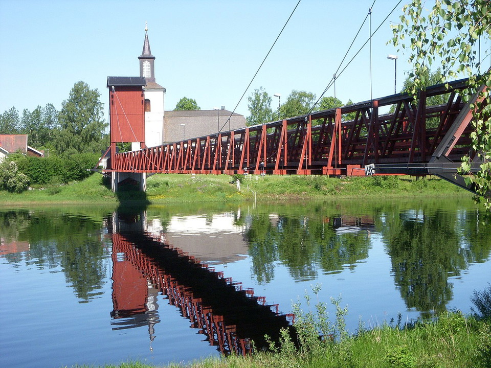
The trail takes you over both paved road, gravel road and hiking trails. In the strikingly beautiful Dala-Floda, you walk through the village along the west valley river, pass the church and cross Sweden's longest wooden bridge via the church to walk along…

Hiking

Ösjörundan

  • Municipality: Gagnef
  • 6625.91 km away from you
  • 6.9 km

The trail includes old paths around Lake Ösjön in connection with the Ösjöbuan, Grönvall and Västtjärnslindan pastures in Mockfjärd. The trail was inaugurated in August 2018 and is a tribute to previous generations to remind us of the extensive pastoral far…

Hiking

Fäbodledsområde 1 Mojeberget

  • Municipality: Gagnef
  • 6621.67 km away from you
  • 61.5 km

I Gagnefs kommun finns ett unikt ledsystem om 480 km som en gång knöt samman de många fäbodarna och byarna. Lederna täcker hela kommunen och flerhundraåriga kulturstigar som passerar kolmilor, slogbodar och storslagna naturupplevelser. Friluftsfrämjandet ar…

Hiking

Sångån vandringsled

  • Municipality: Gagnef
  • 6611.03 km away from you
  • 6.0 km
  • Difficulty: Blue

Along the eastern side of Sångån, a path winds between logs and stones. Mainly through older forest. One can imagine that the rafts went here at the time they had a big job to make sure that the logs came down in good order to Flosjön. Or is it the path of…

Hiking

Fäbodledsområde 9, Lövberget

  • Municipality: Gagnef
  • 6613.02 km away from you
  • 38.7 km

Gagnef municipality has a unique trail system of 480 km that once linked the many pastures and villages. The trails cover the entire municipality and centuries-old cultural trails that pass charcoal kilns, huts and magnificent nature experiences. Lövberget…

Hiking

Fäbodledsområde 11, Täcksberget

  • Municipality: Gagnef
  • 6601.47 km away from you
  • 41.9 km

Friluftsfrämjandet i Gagnef har ett unikt vandringsledssystem som består av 480 km leder i ett nätverk som täcker hela kommunen. Syftet med lederna är att stödja det rörliga friluftslivet och bevare de hundraåriga kulturstigarna. Det är i huvudsak fäbodsti…

Hiking

Fäbodledsområde 2 Djurmo klack

  • Municipality: Gagnef
  • 6626.36 km away from you
  • 20.3 km

Gagnef municipality has a unique trail system of 480 km that once linked the many pastures and villages. The trails cover the entire municipality and centuries-old cultural trails that pass charcoal kilns, huts and magnificent nature experiences. Friluftsfr…

Hiking

Myrtjärnen runt

  • Municipality: Gagnef
  • 6622.06 km away from you
  • 2.1 km

Myrtjärnen is a lake in Gagnef municipality in Dalarna and is part of Dalälven's main catchment area. Around the lake is a nice shorter trail that goes into Myrtjärnens nature reserve.

Hiking

Storhällaleden

  • Municipality: Gagnef
  • 6614.19 km away from you
  • 4.1 km
  • Difficulty: Green

Storhällaleden går från centrala Dala-Floda genom ett varierat skogsområde intill Flosjön in i Storhälla naturreservat. Längs leden kan man upptäcka skogen med gamla träd, ovanliga vedsvampar och se spår av äldre brukande. Väl framme i reservatet kan du sit…

Hiking

Fäbodledsområde 4 Björkaberget

  • Municipality: Gagnef
  • 6625.49 km away from you
  • 47.0 km

Gagnef municipality has a unique trail system of 480 km that once linked the many pastures and villages. The trails cover the entire municipality and centuries-old cultural trails that pass charcoal kilns, huts and magnificent nature experiences. Friluftsfr…

Hiking

Fäbodledsområde 5, Mockfjärd södra

  • Municipality: Gagnef
  • 6622.58 km away from you
  • 48.4 km

Gagnef municipality has a unique trail system of 480 km that once linked the many pastures and villages. The trails cover the entire municipality and centuries-old cultural trails that pass charcoal kilns, huts and magnificent nature experiences. Friluftsfr…

Hiking

Fäbodledsområde 13, Backmon

  • Municipality: Gagnef
  • 6628.97 km away from you
  • 8.5 km

I Gagnefs kommun finns ett unikt ledsystem om 480 km som en gång knöt samman de många fäbodarna och byarna. Lederna täcker hela kommunen och flerhundraåriga kulturstigar som passerar kolmilor, slogbodar och storslagna naturupplevelser. Friluftsfrämjandet ar…

Best hiking trails in Gagnef

Naturkartan samlar de vandringslederna i Gagnef som är populärast bland våra användare.

Naturkartan

Open this in the app