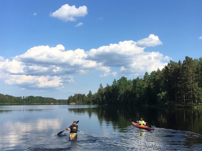
Bästa paddellederna för kajak eller kanot i Östergötlands län

Östergötlands län

Naturkartan samlar de paddellederna för kajak eller kanot i Östergötlands län som är populärast bland våra användare.

Images

Map

44 Bästa paddellederna för kajak eller kanot i Östergötlands län

Paddling

Stångåns och Kinda kanals kanotled

  • Municipality: Kinda
  • 50.9 km

The Stångån water system is perhaps the county's best paddling water. You can start far upstream of Vimmerby and paddle all the way down to Roxen. Here is a description of the lower parts of the canoe route, from Rimforsa to Roxen. The route is a little ove…

Paddling

Paddlingstur: Klassikern Kallsö runt

  • Municipality: Söderköping
  • 6831.15 km away from you
  • 10.6 km

Suggested paddling trip, full day, with about 5-8 hours of paddling. The classic Kallsö round, starting from Mon. Perfect for paddling with children, lots to discover. A trip for anyone who likes a living archipelago culture. Make a stop at the fisherman on…

Paddling

Kanotled Svartån

  • Municipality: Boxholm
  • 6746.15 km away from you
  • 78.9 km

Paddla längs med Svartån från Sommen till Roxen. Genom den rika Östgötaslätten rinner Svartån drygt 70 km och med en fallhöjd på 130 m. En liten del av svartån går genom Motala kommun. Vattnet är reglerat vilket medför flera lyft men också på flera ställen…

Paddling

Grytstriangeln

  • Municipality: Valdemarsvik
  • 6843.30 km away from you
  • 40.0 km

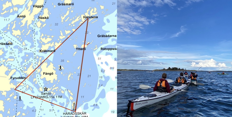
Discover Gryt's fantastic archipelago with the Gryt Triangle. Perfect 3-day tour with overnight stays on Harstena and Häradskär, experience two unique islands with long archipelago history. Start from the kayak center on Ekön's nature reserve, then paddle u…

Paddling

Paddlingstur: Tusen kobbar och skär

  • Municipality: Söderköping
  • 6831.24 km away from you
  • 39.3 km

Suggested paddling trip, two days, with about 4-6 hours of paddling per day. Thousand islets and skerries, starting from Mon or Tyrislöt. Beginner-friendly but requires good orientation skills. A jumble of small skerries in the sea band and few open passage…

Paddling

Kanotled längs Göta kanal

  • Municipality: Motala
  • 6742.21 km away from you
  • 18.5 km

Göta kanal präglas av lugn och tidlöshet. Med denna kanotled kan ni ta er från sjön Boren vid Borensberg, genom Göta kanal, och hela vägen till Malfors gästhamn i Ljungsbro. Totalt sträcker sig leden hela 20 km. Från Borensberg följer man Långkanalen, en sl…

Paddling

Kanotled från Ommen till Tron

  • Municipality: Motala
  • 6739.81 km away from you
  • 16.9 km

From Lake Ommen at Kvarn, the trail goes via Kvarnsån and Storån to Stora Tron, which is at the county border. The trail then continues to Finspång and Lake Glan. To see more canoe trails follow this link: Tisnarensystemet - Kanotguiden

Paddling

Paddlingstur: Missjö naturreservat

  • Municipality: Söderköping
  • 6836.99 km away from you
  • 10.7 km

Suggested paddling trip about 2-3 hours with stops for swimming and lunch. Missjö nature reserve, starting from Tyrislöt. Partly in the vicinity of the fairway and partly exposed to wind south/north. A trip to Missjö and up to Missjö nature reserve, where y…

Paddling

Ämmern runt

  • Municipality: Kinda
  • 6786.70 km away from you
  • 24.1 km

Beautiful loop through the Skedevid canal that connects Åsunden and Ämmern. The entire route is a longer full-day trip for the experienced canoeist, but the route can be shortened according to your own wishes. The trail is narrow in places, which provides c…

Paddling

Kanotled Boren

  • Municipality: Motala
  • 6732.39 km away from you
  • 31.1 km

This trail takes you around Lake Boren, which extends for about 35 km. Boren has its inflow from Vättern at Motala stream and has good water quality. There are many beautiful places around Boren that connect Borensberg with Motala. One of these places is Bi…

Paddling

Åsundabadet-Hallarön

  • Municipality: Kinda
  • 6786.69 km away from you
  • 6.1 km
  • Difficulty: Blue

From the loading site at Åsundabadet, the canoe trail goes through the northern parts of Åsunden down to Hallarön. There are windbreaks, rubbish bins and the possibility of swimming. Note the weather and any fire bans before you go out on islands. Firing on…

Paddling

Hallarön-Råsöbadet

  • Municipality: Kinda
  • 6790.17 km away from you
  • 10.6 km
  • Difficulty: Blue

From Hallarön, the canoe trail goes south towards Råsöbadet. The trail goes through Ulvesund and between Gäddnäset and Sätra you glides in between mighty heights on both sides. Once at Råsöbadet's sandy beach, there is a toilet and rubbish bins. Note the we…

Paddling

Trossbonäs badplats-Horn hamn

  • Municipality: Kinda
  • 6803.86 km away from you
  • 6.9 km
  • Difficulty: Blue

At Trossbonäs, the water is relatively open, which provides magnificent views, but sometimes also strong gusts of wind. Southwards towards Horn, the landscape becomes somewhat denser and the water is usually calmer. In Horn's harbor there is access to fresh…

Paddling

Äpplerum-Hällefors

  • Municipality: Kinda
  • 6805.09 km away from you
  • 4.3 km

Subsection with relatively calm waters, where the water flow is from south to north, like the rest of the subsections.

Paddling

Kanotled i Salstern

  • Municipality: Motala
  • 6726.99 km away from you
  • 17.0 km

The forest lake Salstern is popular in early summer when it offers warmer bathing temperatures than the larger lakes in Motala municipality. The canoe trail extends around the entire lake, along the shoreline. Here you will paddle past countless bathing pea…

Bästa paddellederna för kajak eller kanot i Östergötlands län

Naturkartan samlar de paddellederna för kajak eller kanot i Östergötlands län som är populärast bland våra användare.

Naturkartan

Open this in the app