
-
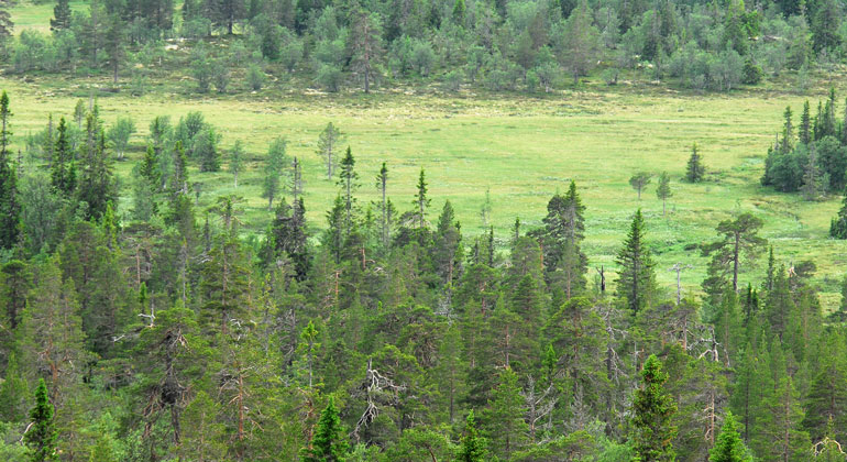
Photo: Sebastian Kirppu, Länsstyrelsen i Dalarnas län
Lillådalen, Naturreservat
- Nature reserve
- County: Dalarnas län
Actions
Description
The Lillådalen Nature Reserve begins in the north at Erik-Knutsåsen, a hill 859 meters above sea level located next to the Mörkret-Gördalen road. Here, there is an observation tower that offers a magnificent view of the mountain landscape in western Särna. From here, you can also see the reserve extending southward along the slopes of Lillådalen and Östra Hållan. The reserve forms a link between Fulufjället National Park to the south and Drevfjället Nature Reserve to the north.
Vegetation
The Avundskölen marshland and its northern extension form a large, undisturbed wetland area framed by pine-dominated dry forests and old-growth forest. The marshes vary in terms of both moisture levels and nutrient availability. Most are nutrient-poor, firm-mat bogs with sparse vegetation, but adjacent to the diabase outcrops at Erik-Knutsåsen, there are nutrient-rich fens featuring, among other species, bog bilberry and meadow knapweed.
Sparse mountain birch forests dominate the higher elevations and gradually transition into mixed birch-coniferous forests at lower elevations. Pine forest predominates, especially on the many dry moraine hills. Spruce forests grow along streams and in certain areas with surface runoff, particularly near the diabase bedrock. These are mostly blueberry-type forests, but in places the herbaceous layer is significantly richer in plant species.
Of particular interest in the forested areas are the streams that have carved fairly deep ravines, where one finds a rich flora, including a very valuable moss and lichen flora. Furthermore, there are narrow glaciofluvial erosion channels with special conditions for vegetation. The flora and fauna are otherwise largely the same as in the adjacent Fulufjället National Park. The Fulubågan River is home to brown trout and burbot, while Slättåstjärn Lake has char and some brown trout.
Bedrock and Water
The bedrock consists of Dala sandstone, cut through by an approximately 18-meter-thick layer of Öjediabase. The diabase layer runs north-south along the entire slope. Unlike the rest of Fulufjället, the area exhibits no striking geomorphological features. In places, however, the moraine has a strongly undulating, dead-ice character in the lower parts of the valley.
There are only two lakes in the area: the small Granåstjärnen and the approximately 21-hectare Slättåstjärnen. From these, Skärdalsbäcken flows southward, joining Lillån and eventually Görälven. The northern parts drain through Bellebäcken into Fulubågan and Fulan. On the southern slope, there are a few smaller streams: Görankällan and Sågbäcken, which flow down to the Görälven.
Activities And Facilities
- Nature reserve
Facts
Bildades: 2002Storlek: 2212 haKommun: ÄlvdalenFörvaltare: LänsstyrelsenNatura 2000: Ingår i EU-s nätverk av skyddad natur. Om Natura 2000
Directions
The area is located between Fulufjället National Park and the Drevfjällen Nature Reserve, about 4 mil west of Särna, just before Gördalen.
Regulations
In the reserve, it is not permitted to...
- drive motorized vehicles off-road, with the exception of snowmobiles on marked trails when the ground is covered with snow. Snowmobiles may also be driven on the ice of Slättåstjärnen and for travel between Gammelsätern and the access point on the highway.
- damage living or dead trees and shrubs, dig up plants, or collect mosses, lichens, and wood-dwelling fungi.
Click on the nature reserve’s name and select the “Documentation” tab to view the documents.
Contact
Address
Email address
Organization logotype

Please be aware that some of these texts have been automatically translated.
I’ve been here
I want to go here
Questions & Answers
Ask a question to other Naturkartan users.
Reviews
0 reviews
- 5 :
- 4 :
- 3 :
- 2 :
- 1 :
Users images
No user images yet. Be the first to share!
