
-
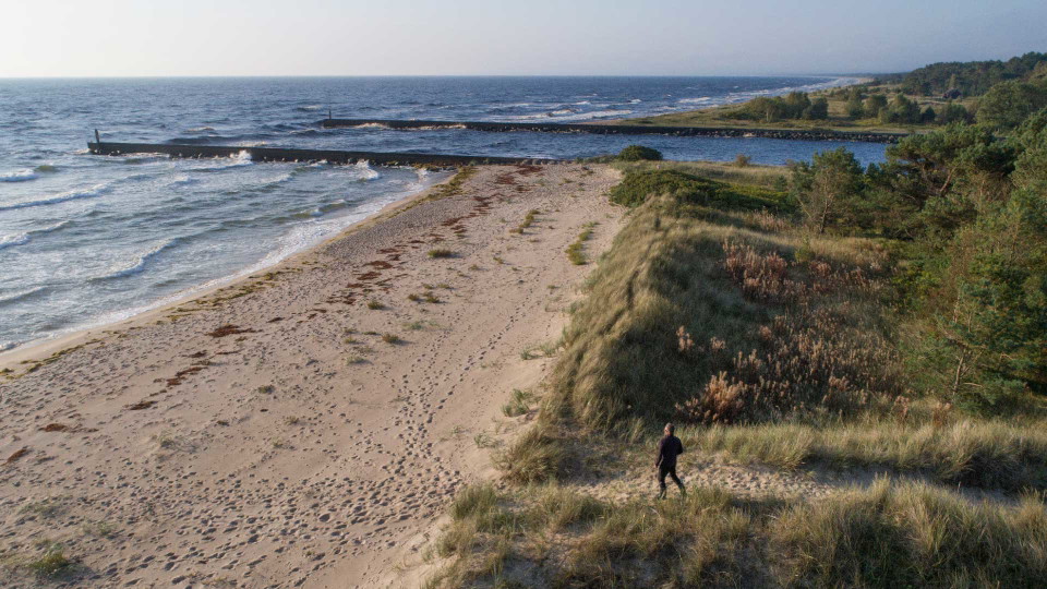
Helge å möter havet i Gropahålet.
Photo: Patrik Olofsson/N -
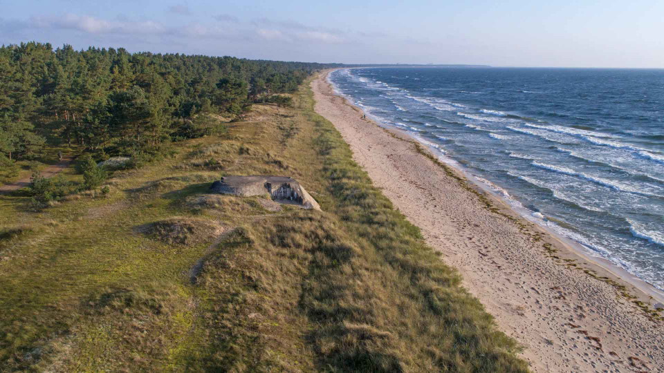
Kustdynlandskapet sträcker sig ett par mil från Åhus till Juleboda
Photo: Patrik Olofsson
Gropahålet, besöksplats i Vattenriket
- The Water Kingdom
- Fishing
- Hiking
- Near parking
- Toilet
- Parking
- Natural Bath
- Bathing
- County: Skåne län
- 6836.64 km away from you
Actions
Description
Gropahålet is the mouth of the river Helgeån in the sea and is located in the dune landscape that stretches 25 km from Åhus in the north to Juleboda in the south. A path leads from the parking lot to the sea. Closer to the beach, the sand dunes tower up. Some are more than 15 meters high. In summer, the long beach attracts bathers. There are both dog baths and natural baths.
Most of the coastline is covered by pine forest. Long ago, large oak forests grew along the coast. The lack of wood and land led to the cutting down of forests even on the poorest land. In the 18th century, the coast was almost treeless. This led to sand drift and the destruction of farmland. Pines and mountain pines were planted to bind the sand. In many areas, the forest has become too dense. Today we know that exposed sandy areas create a mosaic and the conditions for a landscape with high natural values.
In recent years, pine trees have been cleared and species that thrive in the open sand have returned. A scent of thyme and sand cloves rises in the heat, and here and there field bindweed and heath flowers grow.
In the past, the Helge å river only flowed into Åhus. In 1775, the farmers in Yngsjö dug a large ditch to keep the fields dry. When the spring flood came, the river found a new route along the ditch into the sea at Gropahålet. Today this is Helgeån's largest outlet.
Activities And Facilities
- Fishing
- Hiking
- Toilet
- Parking
- Natural Bath
- Bathing
- The Water Kingdom
Accessibility
- Near parking
Parking
There is a large parking lot.
Directions
By bus: Regional bus 551 to the Furuboda Kaptenens väg stop. From here it is 2.3 km to Gropahålets parking lot.
By car: Take road 118 south from Kristianstad, through Åhus and on to Yngsjö. Turn left into Yngsjö community on Gamla byvägen. Turn left onto Torgasträdet. Continue past Kastanjelund and turn right at the next crossroads. Follow the road that runs parallel to the sea for about 1.7 km and turn left at the sign "Naturreservat". The road leads to a parking lot in the middle of the reserve.
Regulations
Gropahålet is a nature reserve. Read more at Länsstyrelsen Skånes hemsida.
Contact
Email address
Kristianstads kommun
Please be aware that some of these texts have been automatically translated.
I’ve been here 1

I want to go here
Questions & Answers
Ask a question to other Naturkartan users.
Reviews
0 reviews
- 5 :
- 4 :
- 3 :
- 2 :
- 1 :
Users images
No user images yet. Be the first to share!
