
-
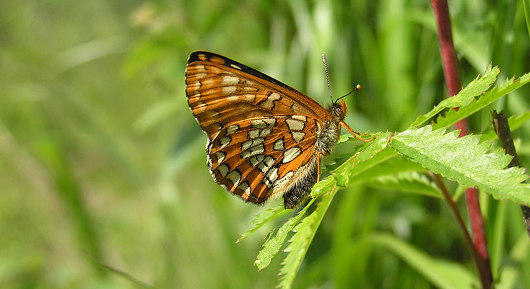
Asknätfjäril.
Photo: Claes U Eliasson
Spångabäcken, Naturreservat
- Nature reserve
- County: Örebro län
Actions
Description
In the Spångabäcken nature reserve, there is a good chance of seeing the beautiful ash moth. The larvae require warmth and live on sunlit small shrubs of ash and olive. The adult butterflies look for nectar in various flowers. The ash moth is very rare and now only occurs in a few areas in Örebro and Stockholm County.
Several rare butterflies
The ash net butterfly is the real rarity of Spångabäck. It has declined sharply throughout Western Europe and is very rare. The reasons are drainage of forest land and other changes in the landscape. In the reserve, you can also spot its relatives, the wet-netting butterfly and the sooty-netting butterfly. They are also rare and have declined, although not as dramatically as the ash moth.
Warm glades
A common feature of the net butterflies is that the larvae require a lot of heat to develop. The slope in Spångabäcken has high solar radiation and is covered by a patchy and uneven-aged forest where it can get really hot in the glades. This also favors the rare aspen leaf beetle, whose larvae live under sunlit bark at the base of coarse aspens.
Herb-rich soils
Down in the valley, the Spångabäcken stream flows in a natural, meandering course. Along the stream there are plenty of herb-rich floodplains with buttercups and lots of meadowsweet. Meadowsweet is crucial to the survival of the wetland butterfly, as it is the only food available to the butterfly's larvae. The abundance of different herbs benefits the reserve's rare butterflies but is also of great importance as a source of nectar and pollen for many other insects.
Cracked valley with old embankment
The Spångabäckens valley is a rift valley. The difference in height between the valley floor and the crest of the steep western side is almost 60 meters. On the slope, you can follow the so-called highest coastline, an old embankment where the sea was at its highest after the last ice age. Among the plants that grow along the embankment are bluebells and haymakers.
Accessibility
Spångabäcken belongs to level 1 in the county administrative board's leveling of the county's nature reserves, which means that the reserve lacks outdoor recreation facilities.
Activities And Facilities
- Nature reserve
Facts
Municipality: Lindesberg
Year established: 2008, 2012 (extended)
Area: 49.8 hectares
Landowner: Swedish Environmental Protection Agency
Manager: County Administrative Board
Reserve creator: County Administrative Board
Natura 2000: The area is part of the EU's network of protected nature, SE0240086 Spångabäcken and SE0240100 Spångabäcken-norra
Directions
The nature reserve Spångabäcken is located about 4 km west of Lindesberg, just south of Munkhyttan.
Regulations
In the nature reserve it is forbidden to:
- remove or damage dead trees or parts of trees
- light a fire other than in a designated place
- catch butterflies without the permission of the county administrative board
Contact
Email address
Organization logotype
Please be aware that some of these texts have been automatically translated.
I’ve been here 4

I want to go here
Questions & Answers
Ask a question to other Naturkartan users.
Reviews
0 reviews
- 5 :
- 4 :
- 3 :
- 2 :
- 1 :
Users images
No user images yet. Be the first to share!
