
-
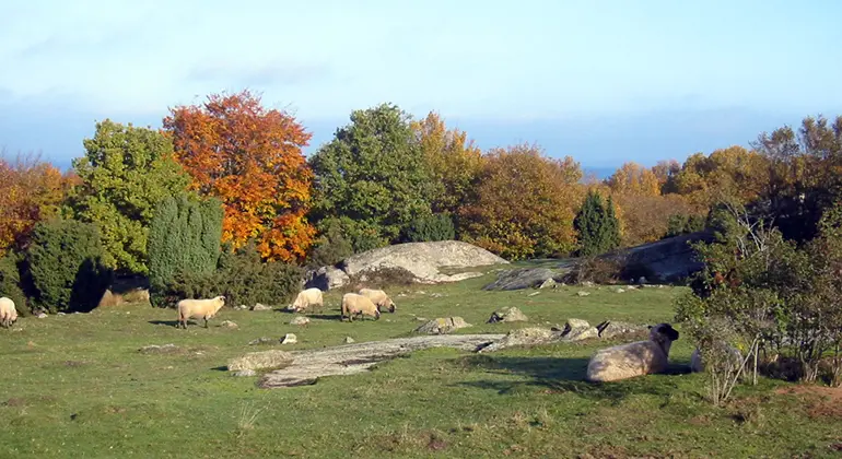
Photo: Ingegerd Erlandsson -
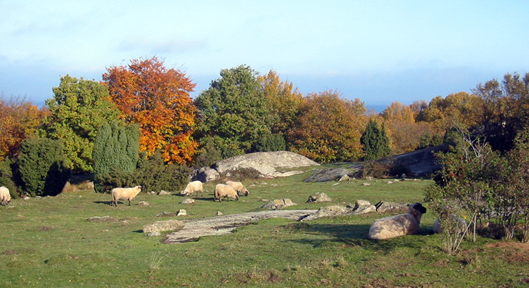
Photo: Ingegerd Erlandsson
Spraglehall, Naturreservat
- Nature reserve
- County: Blekinge län
Actions
Description
When you walk in Spraglehall you will experience flower-rich meadows, beech forests and hazel groves. The nature reserve is old pasture land from a long time ago. The area is still grazed. Spraglehall's highest point is 25 meters above sea level and from the top there is a nice view of Listerlandet and the Baltic Sea. There are memories of the stonemasonry period.
Spraglehall is one of Listerlandet's remaining mountains with varied nature with grazed grasslands, forests and rocky outcrops. The area, located by the sea near the community of Krokås, is easy to get to.
Memories from the ice age
Listerlandet has a number of so-called remnant mountains of varying heights. The mountain itself consists of coarse eye granite of the Karlshamn type, while the surrounding bedrock consists of smoothly eroded chalk limestone.
During the last ice age, the residual mountains were given their final shape by grinding the rock core. Most of the highest parts consist of flat, extensive outcrops. The outcrops contain ice grooves that run in the direction of the ice sheet, north-northeast - south-southwest.
The side facing the ice movement is called the impact side. The impact side was smoothed as the ice slid over it. On the opposite side, the leeward side, moraine material accumulated. Such a formation is called a drumlin and is of great geological interest.
Parts of Spraglehall in Berlin
For a few years in the 1910s and 20s, there was a thriving stone industry here. Paving stones and kerbstones were cut for export to Germany. It was a Danish company that was the exporter. A massive jetty was built to enable the stone to be shipped out by ship.
Remains of old rails can still be seen today, both at Massa brygge and up in the quarry. Despite two world wars, many streets in German cities, including Hamburg and Berlin, are still lined with stone from Spraglehall. Many stonemasons in Listerlandet worked at Spraglehall quarry.
Activities And Facilities
- Nature reserve
Facts
Year of protection: 1971. Updated decision and new management plan 2010
Municipality: Sölvesborg
Character: Residual mountain with pasture, hornbeam forests, rocky areas and hazel groves, coastal meadow
Area: 11 hectares
Landowner: The state
Manager: Blekinge County Administrative Board
Type of protection: Nature reserve and Natura 2000
Directions
Spraglehall is located north of the small community of Krokås, which lies due east from Mjällby on Listerlandet. Follow the road from Hörvik through Krokås community to the end of the road. The nearest bus stop is Krokås about 400 meters north of the reserve.
Regulations
You are welcome to visit Spraglehall, but please note that it is not allowed to
- damage land
- destroy or damage any fixed natural object or surface formation
- remove or damage cultural heritage features such as stone walls and roads
- unduly disturb wildlife
- damage growing trees and shrubs or vegetation in general, or remove dead wood
- digging up plants
- capture or collect invertebrates in such a way as to damage or destroy their biotopes or reproductive habitats
- carry an unleashed dog or other stray pet, except for dogs used for searching
- drive a motorized vehicle other than on the designated road to the parking area of the reserve
- riding, driving a horse or cycling other than on roads and paths designated for this purpose
- camping or setting up a caravan or motorhome
- light a fire other than where there is a designated fireplace
- make disturbing noise.
Without permission from the county administrative board, you may not
- pick mosses, lichens or wood-living fungi, other than what is reasonably necessary for species identification
- conduct scientific research involving sampling or installation of equipment
- affix any board, placard, poster, sign, inscription or similar device, except for information and reserve signs and boundary markers
- use the area for competitions, exercises, camps or other activities that may disturb the natural environment or outdoor recreation.
Contact
Email address
Länsstyrelsen Blekinge
Organization logotype
Please be aware that some of these texts have been automatically translated.
I’ve been here 1

I want to go here 1
Questions & Answers
Ask a question to other Naturkartan users.
Reviews
0 reviews
- 5 :
- 4 :
- 3 :
- 2 :
- 1 :
Users images
No user images yet. Be the first to share!
