
-
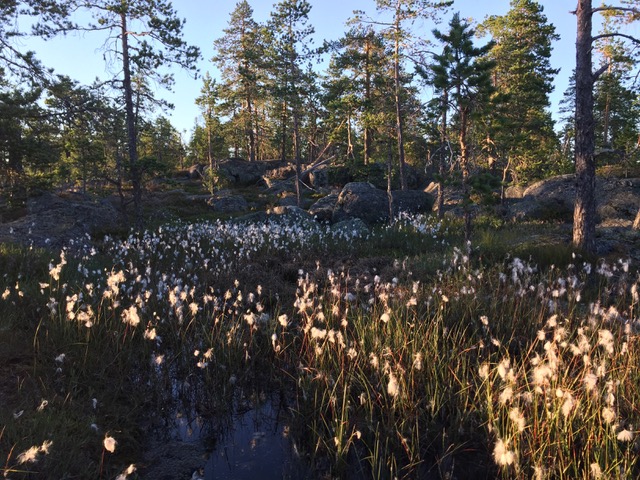
Blomåkersberget
Photo: Visit Umeå
Tio toppar Tavelsjö - Blomåkersberget
- Hiking
- County: Västerbottens län
- 6658.27 km away from you
Trail details
- Length 1.1 km
Actions
Description
The hike up to Blomåkersberget goes over very beautiful rocky areas and small cliffs and crevices.
On Midsummer's Eve in the 1970s, a fire raged in the area popularly known as Kvärnto, west of the mountain. Firefighters from Tavelsjö, Vännäs and Umeå and from the Västerbotten I20 regiment fought the fire. But they crashed their cars so badly that the landowners were liable for damages. The fire field with its sooty stumps is located on the mountain's western slope some hundred meters from the top. Blomåkersberget's saddest story is about how a Finnish soldier from the Finnish Winter War, later living in Tavelsjö, ended his life in a hut at the foot of the mountain. The beautiful lake Kvännsjön, framed between marshes and mountains west of Blomåkersberget, may be worth a detour.
Activities And Facilities
- Hiking
Facts
82 meters in altitude, 1.1 km hike, about 30 min.
Contact
Email address
Kontakta Visit Umeå
Organization logotype

Please be aware that some of these texts have been automatically translated.
I’ve been here 7



I want to go here 15


Questions & Answers
Ask a question to other Naturkartan users.
Reviews
0 reviews
- 5 :
- 4 :
- 3 :
- 2 :
- 1 :
Users images
No user images yet. Be the first to share!
