
-
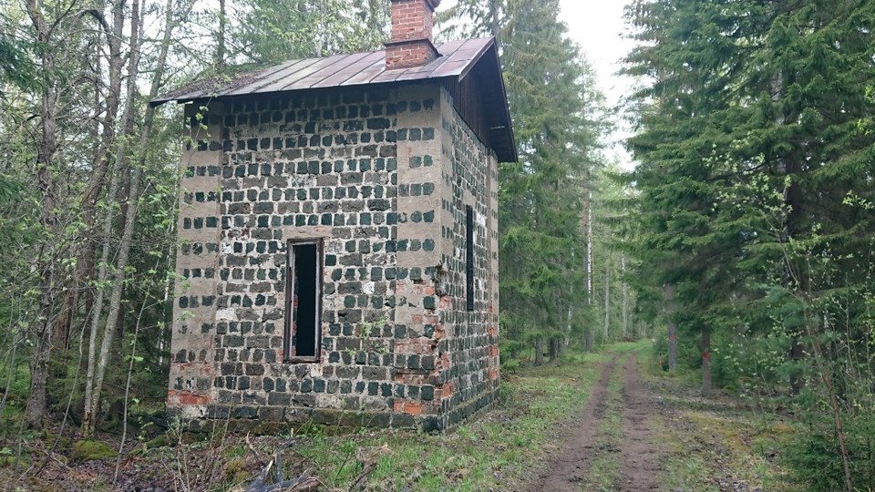
Från Brattfors. Foto: Maria Hammarström 2021
Ockelbo-Brattfors, Biking Gästrikland
- Mountainbiking
- Near Public Transport
- County: Gävleborgs län
Trail details
- Length 4.2 km
- Difficulty Blue - medium
Actions
Currently
Leden är påverkad stormen Johannes och kan vara svårframkomlig tills dess att träd som fallit över leden tagits bort av fastighetsägarna. Var alltid försiktig i närheten av vindfällen och lutande träd.
Visa stor försiktighet, undvik svårframkomliga partier och vänd om förhållandena känns osäkra.
Description
Lightly cycled connecting trail that runs along the old embankment after the narrow-gauge railway.
Activities And Facilities
- Mountainbiking
Accessibility
- Near Public Transport
Downloads
Contact
Email address
Föreningen Naturkraft Gästrikland
Organization logotype
Please be aware that some of these texts have been automatically translated.
I’ve been here
I want to go here
Questions & Answers
Ask a question to other Naturkartan users.
Reviews
0 reviews
- 5 :
- 4 :
- 3 :
- 2 :
- 1 :
Users images
No user images yet. Be the first to share!
