
-
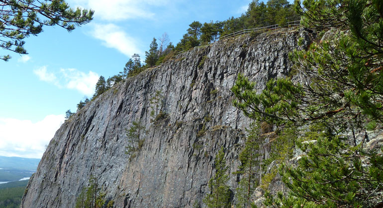
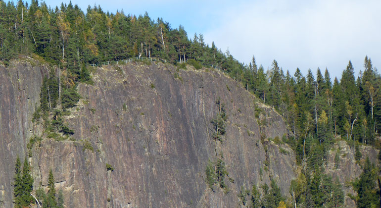
Branten på Hykjeberget är verkligen brant! Vid kanten finns ett räcke så du kan stå och titta på utsikten och känna dig säker.
Photo: Lennart Bratt, Länsstyrelsen i Dalarnas län. -
-
-
-
-
-
-
Hykjeberget, Naturreservat
- Nature reserve
- County: Dalarnas län
Actions
Description
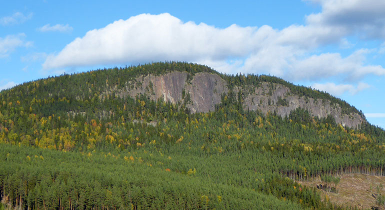
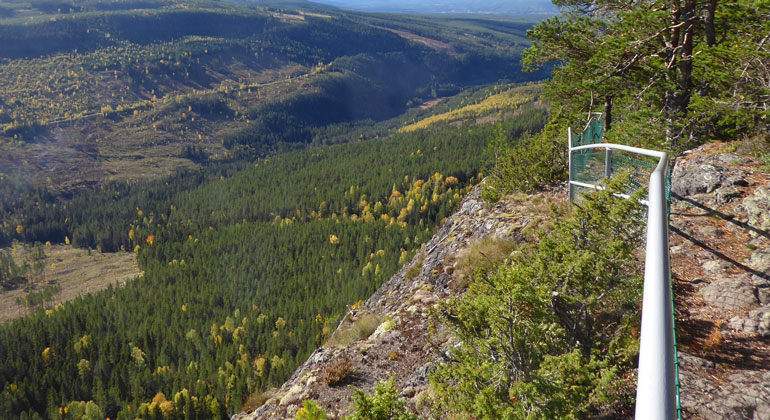
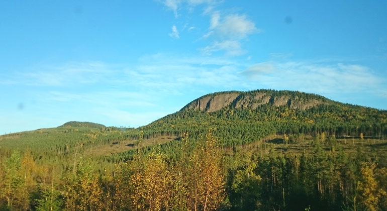
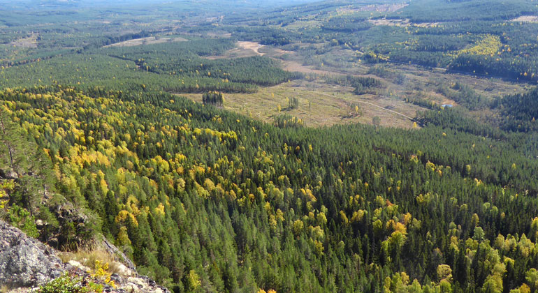
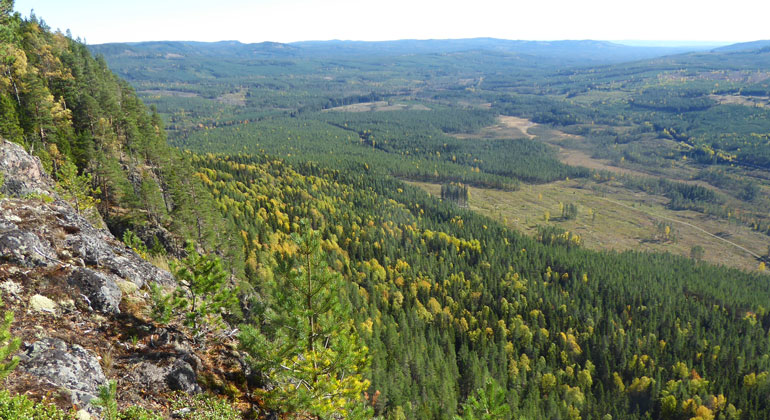
With its steep cliffs, Hykjeberget rises like a giant in the forested landscape. The mountain faces south and therefore absorbs a great deal of heat from the sun. This results in rich and unique vegetation. From here, the view stretches for miles. The hiking trail up the mountain is both steep and rocky. But at the summit, a wind shelter awaits for a pleasant rest.
What can you do here?
High elevations offer wonderful views
Hykjeberget is a majestic mountain located one mil northeast of the town of Älvdalen. The summit itself rises to 594 meters above sea level. Below the summit, the mountain plunges down a nearly vertical cliff face 100 meters high.
The mountain is a pleasant and popular destination with sweeping views. Below the cliff are slopes filled with fallen boulders.
Hike here and rest on a royal bench
There is a road leading to a parking lot north of the area. From there, it’s not far up to the summit. The trail is rocky, and after rain, the roots can be slippery. So take your time and let the slowest person in your group go first.
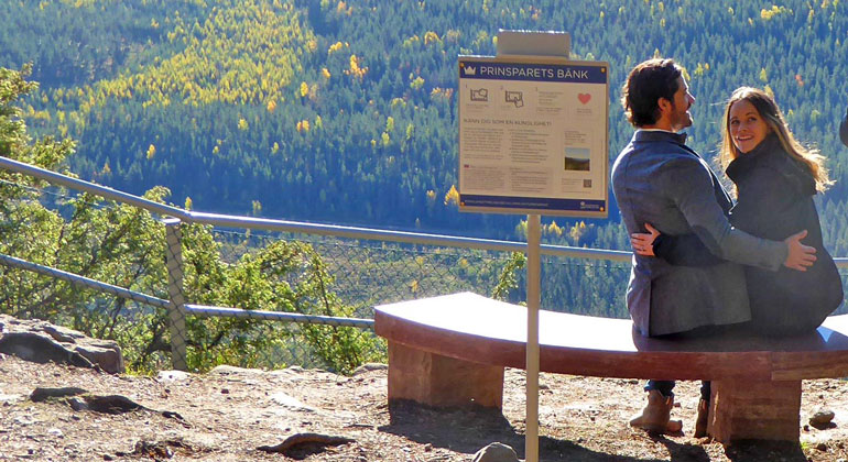
Once you reach the top, you can rest on the bench that Prince Carl Philip and Princess Sofia received as an engagement gift from the people of Dalarna. It was dedicated by the royal couple in September 2016, as shown in the slideshow above.
Photo in the slideshow above: Maria Jons, Dalarna County Administrative Board.
Climbing is in progress, so please be considerate!
What makes this place unique?
Unique Flora
Hykjeberget is a true “southern-facing mountain.” It’s a phenomenon where biology and geology interact to create special conditions. Southern-facing mountains have a side that faces south, east, or west.
The slope’s ability to store heat causes the mountain to release heat into its surroundings, primarily during the fall and winter. This creates a favorable local climate that supports demanding plants—often species that are otherwise only found further south.
As early as 1734, Carl von Linné visited Hykjeberget and described the distinctive flora at the foot of the mountain slope. Here you can find species that are otherwise rare in these parts—maple, linden, wood sorrel, sweet woodruff, goat’s beard, and forked fern. There are many linden trees—more than 40—making this one of Dalarna’s richest linden stands.
Forest Shaped by Grazing and Fire
The forest in the area varies greatly, depending on the elevation at which you find yourself. But it also varies due to how the forest was used in the past. Here, the local people have gathered firewood and timber. And livestock from the nearby mountain pastures have grazed on the slopes.
Forest fires were also more common in the past. Thick, old stumps with multiple scars from fires—known as “fire scars”—can be seen here and there in the forest. The sun-exposed, dry slope is obviously highly flammable. Around 1990, an area near Persgrav burned, and many traces of the fire are still visible here today.
It’s Not Just Plants That Love the Cliff
Many species thrive on the warm cliff face. Here you might see a raven gliding by and cawing, or a mountain buzzard and a kestrel soaring. If you get down on all fours, you might spot one of the 25 different species of snails and slugs that have been found here. This is one of the richest sites in Dalarna for this group of animals.
On the burned area in the southwest, a number of rare beetles have been found—all of which depend on recurring fires. The mountain’s favorable local climate also contributes to the abundance of butterflies here.
Entrances to Hykjeberget
North Entrance, Main Entrance:
Drive through the entire village of Klitten on Klittenvägen (which then becomes Torrlidsvägen and Åjkvägen). After passing through the village, follow the signs toward the Nature Reserve; after about 5 km, you’ll arrive. At the parking lot, there’s a table where you can have a snack, as well as information signs.
The trail to the summit of Hykjeberget starts here. The trail itself is about 1 km long, but it’s steep and rocky in places. Once at the top, you’ll find a wind shelter with a barbecue area, an outhouse, and, of course, the beautiful stone bench that the royal couple received as an engagement gift. Take the same route down that you took up!
South Entrance:
In the village of Liden, turn right onto Liden Road and then continue on Nässjö Road for 5 km. At the end of the road, there is a turnaround with parking and a signpost with information about the nature reserve. A 2-km one-way trail starts here, which also leads up to the summit of Hykjeberget.
The trail is slightly steeper than the one starting from the main entrance but is well-trodden and easy to follow. In places, it runs alongside a lovely stream. Keep in mind that forest roads are not always in good condition for driving. In early spring and during the thaw, the road may be closed for a period of time to prevent damage.
Activities And Facilities
- Nature reserve
Facts
Bildades: 1990/2015/2024Storlek: 143 haKommun: Mora och ÄlvdalenFörvaltare: LänsstyrelsenNatura 2000: Ingår i EU-s nätverk av skyddad natur.Om Natura 2000Beskrivningen av områdets Natura 2000-värden går att läsa i skötselplanen från 2015.
Directions
About 10 km northeast of the town of Älvdalen.
Regulations
The following activities are not permitted in the reserve:
- damage growing or dead trees—whether standing or fallen—as well as stumps and shrubs,
- drive motorized vehicles off-road, whether on bare ground or snow-covered ground, with the following exceptions: Riding snowmobiles on marked snowmobile trails when the ground is covered with snow,
- lighting fires outside of areas designated by the County Administrative Board,
- camping outside of areas designated by the County Administrative Board,
- causing damage to the ground or geological features, or damaging boulders and rocks, e.g., by chiseling, drilling, or hacking, with the following exception: – Activities specified in Appendix 5 within existing climbing routes.
- climbing on rock faces, with the following exception: – Climbing is permitted along the climbing routes located within the area delineated in Appendix 5, and with due consideration for any nesting bird species, etc., in accordance with Appendix 6.
Without a permit from the County Administrative Board, it is also prohibited to:
- dig up plants, pick mosses, lichens, and wood-dwelling fungi, or collect animals (e.g., insects),
- organize or conduct competitions, camp activities, and other large-scale or recurring organized events.
Click on the nature reserve’s name and select the “Documentation” tab to view the documents.
Contact
Address
Email address
Organization logotype

Please be aware that some of these texts have been automatically translated.
I’ve been here 3


I want to go here 5

Questions & Answers
Ask a question to other Naturkartan users.
Reviews
0 reviews
- 5 :
- 4 :
- 3 :
- 2 :
- 1 :
Users images
No user images yet. Be the first to share!
