
-
Vättaberget, Hammarstrand
Vandringsled Vättabergsleden, Hammarstrand
- Hiking
- Walking
- Running
- Guide: Ragundadalen
- 6545.87 km away from you
Trail details
- Length 5.6 km
- Difficulty Blue - medium
Actions
Description
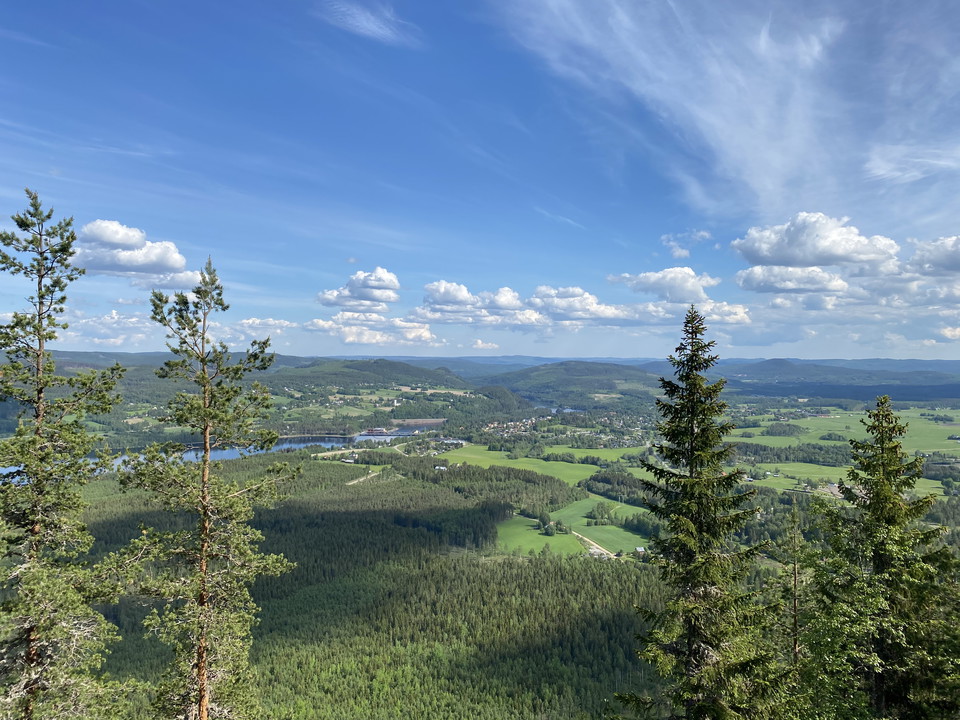
Vättaberget is the mountain you see when you cross the Indalsälven into Hammarstrand and which is called "Elephant Mountain" in the vernacular as it looks like a lying elephant. You can walk the trail up to the top and then get a nice view of the valley!
- Starting point:** Kullstabacken parking lot. Follow the red markings.
- Height difference:** 247 m
The trail starts with a short stretch, slightly uphill, on a gravel road to the foot of Vättaberget. From the foot up to the top of the mountain, there may occasionally be quite steep sections for about 1 km, but once at the top you have a fantastic view of the Hammarstrand area and into the Indalsälven valley towards the coast! There is a barbecue area and windbreak.
The trail then continues around Skalstjärnen and back to Slalombacken's parking lot.
Activities And Facilities
- Walking
- Running
- Hiking
Contact
Address
Ragunda kommun
0696-68 20 00
Email address
Ragundadalen
Please be aware that some of these texts have been automatically translated.
I’ve been here 6


I want to go here 3
Questions & Answers
Ask a question to other Naturkartan users.
Reviews
2 reviews
- 5 :
- 4 :
- 3 :
- 2 :
- 1 :
Pulshöjande väg upp! Fantastisk utsikt. Promenaden toppades av ett dopp i Skaltjärn när vi var nere igen. Betyget blir inte högsta pga att rundan går en del på tråkig bilväg.
Users images
No user images yet. Be the first to share!

Jag var där 1939, då jag var på sommarkoloni i Hoo. Vi fick titta på utsikten med hjälp av en stor tubkikare som ägdes av en pensionerad sjökapten. Det var fantastiskt, som jag minns det.