New!

Now you can share photos on Naturkartan! 📸

Read more

Best hiking trails in Södermanlands län

Södermanlands län

Naturkartan samlar de vandringslederna i Södermanlands län som är populärast bland våra användare.

Images

Map

251 Best hiking trails in Södermanlands län

Hiking

Krämbolsleden

  • Municipality: Katrineholm
  • 6760.09 km away from you
  • 5.4 km

Krämbolsleden is about 5 km long and runs through varied terrain in the Krämbol outdoor area. The accessible loop is about 3.2 km long and connects to the road from Krämbolsstugan. Along the trail there are information boards about nature. Along the trail y…

Hiking

Duveholmsleden

  • Municipality: Katrineholm
  • 6764.84 km away from you
  • 2.0 km
  • Difficulty: Green

Dufweholmsleden is a trail that goes around part of Duveholmssjön is very attractive and varied with many nice nature experiences. Follow the markings after the trail and you will get around. There are many connections to the trail so you can choose your ow…

Hiking

Sörmlandsleden route 56 Trosa - Tullgarns slott

  • Municipality: Trosa
  • 6834.24 km away from you
  • 20.0 km
  • Difficulty: Blue

After hiking through Trosa, along the well-known promenade, it is time for new adventures towards Tullgarn castle. The first kilometers consist of streets and country roads through the outskirts of Trosa. Then follows beautiful coastal trails and after abou…

Hiking

Loop trail with detours to the coast, Eriksö

  • Municipality: Trosa
  • 6838.88 km away from you
  • 5.8 km

Gravel roads and winding trails take you through Eriksö's beautiful and diverse natural landscape. Starting from the car park at Klubbsundet, a marked trail makes a winding loop through the central parts of the nature reserve. Don't miss the marked detours…

Hiking

Hälsans stig - Mariefred

  • Municipality: Strängnäs
  • 6798.47 km away from you
  • 6.9 km

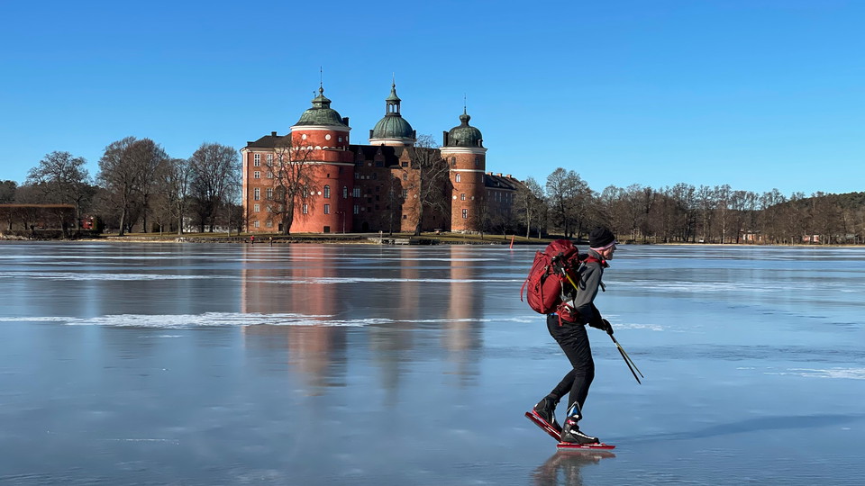
The path runs along Lake Mälaren with a view of Gripsholm Castle, further along Strandvägen and eventually north towards Målartorp and Slottsbrinken.

Hiking

Nävsjön runt, delvis Sörmlandsledens etapp 36

  • Municipality: Nyköping
  • 6808.13 km away from you
  • 7.8 km
  • Difficulty: Green

A very popular circular trail. Summer and winter - always just as nice More info can be found at Rundslinga Nävsjön runt - Sörmlandsleden (sormlandsleden.se) 7818

Hiking

Äspskärleden

  • Municipality: Nyköping
  • 6836.45 km away from you
  • 1.9 km

Hiking

Vandringsslinga Grävsjön runt

  • Municipality: Vingåker
  • 6736.18 km away from you
  • 4.0 km
  • 1 h
  • Difficulty: Green

Very nice hike along the shore of Grävsjön and on through the picturesque community of Högsjö with mill area. Along the trail there are four barbecue areas, a windbreak and jetties for fishing or swimming. Dry toilets are available adjacent to the parking lot.

Hiking

Rundslinga Näset, Tullgarn

  • Municipality: Trosa
  • 6836.14 km away from you
  • 2.6 km

Näsudden—a beautiful headland with pastures and beach meadows, is located in the north-eastern part of the reserve. There is a parking lot by the entrance, with a wheelchair-accessible toilet, grill and picnic area. The Rundslingan loop trail takes you thro…

Hiking

Hälsans stig - Nyköping

  • Municipality: Nyköping
  • 6818.29 km away from you
  • 6.0 km

Walk past historical sites, the sea and through pleasant residential areas. Hälsans Stig in Nyköping - a trail that is good for your health and well-being. Read more at nykoping.se and landstinget.sormland.se

Hiking

Genneleden

  • Municipality: Katrineholm
  • 6761.14 km away from you
  • 3.0 km

The trail is about 3 km long. It provides the opportunity to walk around Lillsjön, via Genne and Krämbol without having to go on the highway. It is possible to get there with a stroller. Some slopes can be a little steep. In the area south of Genne, traces…

Best hiking trails in Södermanlands län

Naturkartan samlar de vandringslederna i Södermanlands län som är populärast bland våra användare.

Naturkartan

Open this in the app