
Skellefteå


Hiking
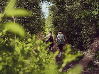
The trail is well marked and offers varied environments and varied landscapes. The trail goes through mixed forest, past marshes and stone slabs. There are also a number of rest areas with wind shelters along the trail.
Hiking
The trail runs through mixed forest, past bogs and rocky outcrops. Along the trail there are a number of rest areas with shelters. Here you will also find, among other things, a charcoal hut and a charcoal base, cairns, memorial stones, old kilometer and milestones.
nature, paths, forest road, dirt road, asphalt,
At Vitberget's rail center or along the northeastern part of Blåsaregatan in Skelleftehamn.
Kundtjänst Skellefteå kommun
![]()
Please be aware that some of these texts have been automatically translated.
Ask a question to other Naturkartan users.
