
-
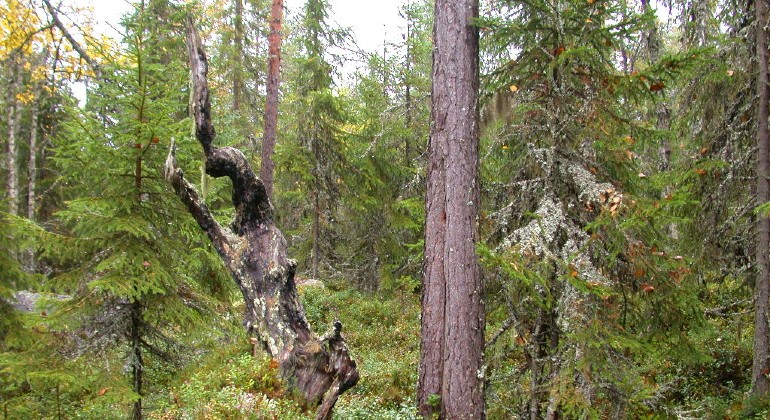
Naturskog med död ved.
Photo: Anita Andersson
Vålhallberget, Naturreservat
- Nature reserve
- County: Värmlands län
Actions
Description
Vålhallberget is dominated by old, species-rich, natural forest-like high-altitude spruce forest. At lower altitudes there is also natural spruce swamp forest.
Although it has been a long time since the last fire, there are plenty of burnt stumps and deciduous trees. In many areas, the forest is now dense with closed and moist spruce-dominated forest areas, rich in, among other things, hanging lichens.
The reserve was established to preserve an area of natural coniferous forest and the typical species associated with old, moist, fire-prone forest.
The forest is close to Vålhallsätern, which is one of the few lakes in Värmland with uninterrupted farming.
Animals and plants
The steep slope down to the surrounding watercourses and the damp climate favor many mosses, lichens and fungi. In addition to the cryptogams, other species also contribute to the unusually high density of disadvantaged and threatened species in the reserve. There are 18 red-listed species and 41 signal species found here. One of the red-listed species is the three-toed woodpecker.
Activities And Facilities
- Nature reserve
Facts
Established: 2009
Size: 191.5 hectares
Landowner: State
Administrator: County Administrative Board of Värmland
Directions
The nature reserve is located in Värmlands län, Torsby municipality, 14 kilometers north of Sysslebäck. From Sysslebäck: Continue north for about 9 kilometers. Turn east at the sign for Granberget. After just over 11 kilometers you come to the reserve. There is no parking lot. You can also reach the reserve by hiking through the Horsstomyren-Storberget reserve, but there is no trail between the reserves. The road barrier may be closed during the thaw.
Regulations
In the reserve it is forbidden to:
- collect invertebrates such as beetles, snails and butterflies
- collecting mosses, lichens and wood fungi
- damaging or removing dead wood, such as lying or standing dry trees or dry branches
- driving vehicles.
Contact
Email address
Maila Länsstyrelsen Värmland
Organization logotype
Please be aware that some of these texts have been automatically translated.
I’ve been here 1
I want to go here
Questions & Answers
Ask a question to other Naturkartan users.
Reviews
0 reviews
- 5 :
- 4 :
- 3 :
- 2 :
- 1 :
Users images
No user images yet. Be the first to share!
