Vandra i Arvika och Eda
Västvärmland kan stoltsera med Värmlands första kombinationsled för vandring och cykel. I Gunnarskog, som ligger…
Hiking
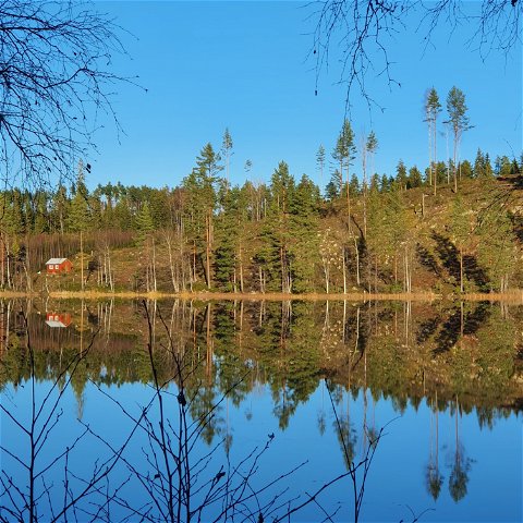
Södra Gunnarskogsleden is a circular trail of nearly 24 km through Gunnarskog's beautiful forest and cultural landscape. The trail takes you through varied terrain with quite some altitude shifts and introduces you to beautiful places like Svartviken at Lake Gunnern, the boulder Rövarstenen, the view point Harstacken, and idyllic tarns. The so called char coal burners' huts and the view tower of Ryggestadberget represent man made elements, which both provide nature impressions. The area offers rich flora and fauna, so the chances of exciting meetings are good.
If you prefer a shorter distance, it is possible to walk parts of the trail and take a short cut back along the car road, see map.
Södra Gunnarskogsleden is Värmland's first combined hiking and biking trail and starts at the Larstomta Hostel in Gunnarskog. The biking trail is marked in a clockwise direction (start to the north) and the hiking trail counter clockwise (to the south). The level of difficulty is rated average for both categories with the following definition:
HIKING
The difficulty of the trail is rated as average, or blue according to the Hiking Värmland standards, with the definition: "Good accessibility. All of, or parts of the trail follows natural paths. Altitude variations are not a problem to a person of normal fitness."
BIKING
The difficulty of the trail is rated as average, or red according to the Biking Värmland standards, with the definition: "The trail includes a great deal of technical stretches. There may be a lot of roots and rocks and the slopes are steeper than those of blue biking trails."
SERVICE: There is a pizzeria in Gunnarskog, and The Local Heritage Center of Gunnarskog has a cafe which is open in summer.
Bus connection 109 and 110, Arvika-Gunnarskog.
From Arvika: Take road 873 to Gunnarskog. The starting point of the trails and Larstomta is situated opposite of the Local Heritage Center and the school.
From Sunne and Gräsmark: take road 869 towards Charlottenberg, at the intersection of Bergatorp you go straight towards Arvika on road 873. After 6 km you reach Gunnarskog, where you take left towards the church. Just after passing the church you find Larstomta on your left, opposite of the Local Heritage Center and the school.
From Charlottenberg: take road 862 towards Gräsmark. At the intersection of Bergatorp you take right, towards Arvika on road 873. After 6 km you reach Gunnarskog, where you take left towards the church. Just after passing the church you find Larstomta on your left, opposite of the Local Heritage Center and the school.
Visit Arvika
Arvika Turistcenter
Storgatan 22
SE 671 31 Arvika
www.visitarvika.se
Visit Arvika

Ask a question to other Naturkartan users.