
-
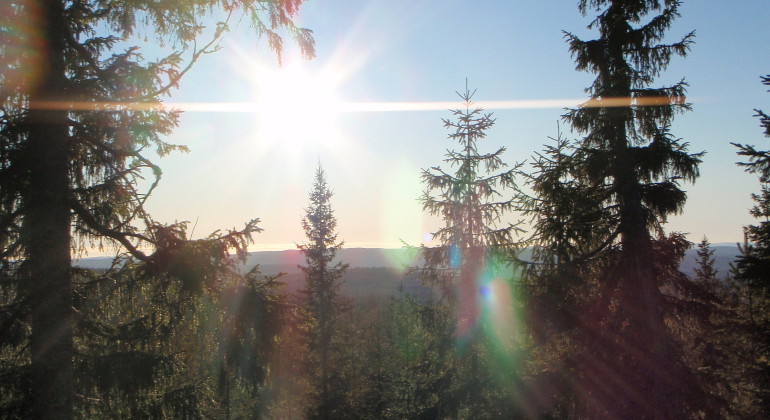
Du kan njuta av viss utsikt i reservatet.
Photo: Linda Stöberg
Norskog Skallberget, Naturreservat
- Nature reserve
- County: Värmlands län
Actions
Description
The reserve was established to preserve the valuable habitat of natural, old species-rich coniferous forest and to preserve disadvantaged and threatened species that are characteristic of the habitats in the area.
The reserve is part of Skallbergen, a high-altitude area that includes several peaks. The highest peak in Norskog Skallberget is 440 meters above sea level and forms the eastern part of the reserve. Ravelsdalen runs right through the reserve. On the heights, the forest is pine-dominated and sparse, with old, late-growing and gnarled trees, while the spruce element increases down the slopes. The spruces are also older and late-growing. Deciduous trees in the form of birch and occasional aspen and willow are scattered throughout the reserve.
The area has a clear fire history. There are many trees with fire sounds. A dry dock shows traces of five fires. Dead wood is found throughout the area, but the largest volumes are found in spruce-rich areas. There are several small marsh areas and acidic swamps in the area.
Animals and plants
The area is home to a number of signal species that indicate forest worthy of protection. Among other things, there is the pine tick. It signals natural forests with old trees and is usually found on trees that are 150 - 200 years old or more. Scented bark is a 'primeval forest indicator', as it occurs mainly in completely or almost completely untouched forests. It is a wood decomposer that grows on the underside of old and spruce logs. On deciduous trees, they include lung lichen and hull lichen. These species grow mainly on old deciduous trees, in light-open environments with a humid microclimate. Other species that can be seen in the area and indicate a forest worthy of protection are violet-grey thorn lichen, broktail and wood bumblebee. The red-listed beetle raggbok has been found in the area. The beetle is dependent on coarse pine logs with hard heartwood.
Activities And Facilities
- Nature reserve
Facts
Established: 2010
Size: 108 hectares
Landowner: State
Administrator: County Administrative Board of Värmland
Directions
Location: Värmlands län, Hagfors municipality, about 15 km west of Hagfors. Drive north from Munkfors, 16 km, on road 62. Turn left towards Lysvik. Continue about 11.5 km to Sågfallet. On the north side of the road you can see Lakenesjön. Turn right (northwest) at Sågfallet. Then continue north for about 5.3 km to Kroktjärnen. Keep right and continue northeast for about 1.4 km and then turn left onto the road where there is a parking area. Then walk just over a kilometer along the road, the reserve is on the hill to the right. Marked trail is missing.
Regulations
In the reserve it is forbidden to:
- collect invertebrates such as beetles, snails or butterflies
- collecting mosses, lichens or wood fungi
- damage or remove dead wood such as lying or standing dry trees or dry branches
- driving a vehicle
- bringing an unleashed dog.
Contact
Email address
Maila Länsstyrelsen Värmland
Organization logotype
Please be aware that some of these texts have been automatically translated.
I’ve been here 2

I want to go here
Questions & Answers
Ask a question to other Naturkartan users.
Reviews
0 reviews
- 5 :
- 4 :
- 3 :
- 2 :
- 1 :
Users images
No user images yet. Be the first to share!
