
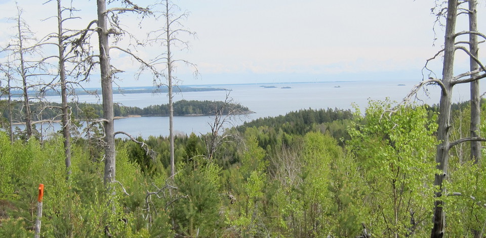


Kycklingleden
- Hiking
- County: Värmlands län
- 6594.69 km away from you
Trail details
- Length 5.7 km
- Time 2 h
- Difficulty Red — demanding
Actions
Description
Activities And Facilities
- Hiking
Facts
SERVICE: The hiking trail is prepared until May 1.
CONTACT: Grum municipality, turism@grums.se , +46 555 420 67
RESPONSIBLE: Grums municipality
Communications
No public transportation.
Directions
From Liljedalsmotet on E18/E45, south of Grums. Take the exit towards Liljedal. (If you come from the north: drive about 400 meters, turn left. Drive about 400 meters, turn right.) Follow the road about 4.5 km. After the bridge, in Liljedal, take the first road to the left, Budavägen. Follow Budavägen about 1km, keep left on the road. At Buda Gård keep right.
Contact
Email address
Kontakta VisitVärmland
Organization logotype

Please be aware that some of these texts have been automatically translated.
I’ve been here 16





I want to go here 15






Reviews
4.2
3 reviews
- 5 :
- 4 :
- 3 :
- 2 :
- 1 :
Questions & Answers
Ask a question to other Naturkartan users.
Users images
Share your photos of the place!





Enkel vandring, vissa branta delar men väldigt fin led