
-
-

Rastplatsen vid Tolfta. -
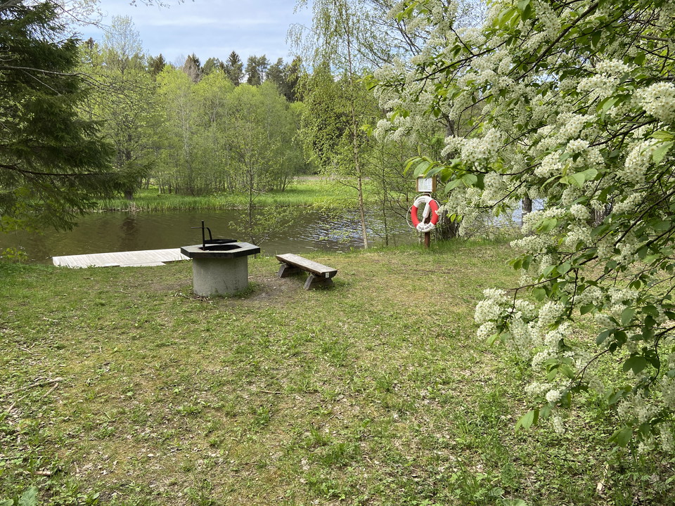
Rastplats söder om Strömsberg. -
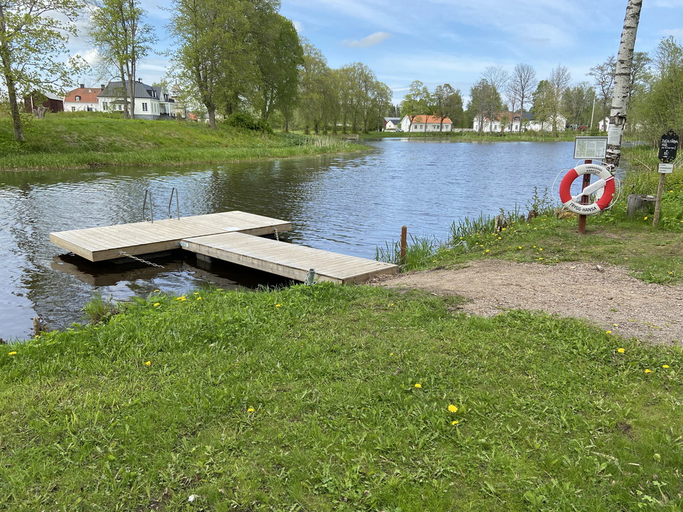
Strömsbergs bruk.
Tämnaråns kanotled, Tierp - Strömsberg, 9 km
- Paddling
- County: Uppsala län
- 6752.77 km away from you
Trail details
- Length 9.0 km
Actions
Currently
**June 27
The high water flow in the Tämnarån has brought reeds and other plant material stuck to the footbridge over the Tämnarån at Gillberga. It affects the bridge and the jetty located upstream, south of the bridge. This bridge cannot be used at the moment. The bridge will temporarily be picked up on land. It will be a little more complicated, but you can still get up here.
Description
Length: 9 km.
Difficulty level: Easy.
Lift: Gillberga, 20 m.
An easy and calm section of the Tämnarån river that takes you from Tierp to the beautiful mill town Strömsberg. Even during dry summers, the water depth is good along the entire stretch. The only lift that may be needed at high tide is to get past the low scooter bridge at Gillberga.
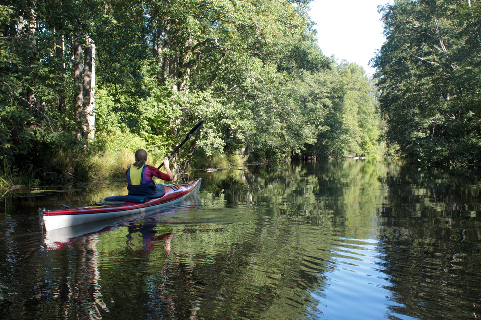
You start at Skämstabron in the southern part of Tierp. There is a dock for loading, a picnic table and the possibility to park. Along the first stretch, the curtain of trees along the shores creates a feeling of paddling in a jungle. After two kilometers you come to Gillbergaspången. At low tide you can paddle under it, but at high tide you may need to take up here and lift past. Take up on the right side and put in at the jetty on the other side.
In Tolfta, in the middle of the stretch, there is a rest area with two shelters, a fireplace and a dry toilet. One of the shelters contains benches and the other can be used for overnight stays. The company Kanot och kajak Tolfta operates on the site, a short distance from the rest area. Here they plan to have canoe rental etc.
Half a kilometer before Strömsberg there is a rest area with a fireplace on the right side. When you paddle into Strömsberg, you end the paddle at the bathing jetty on the right. Strömsberg is called "The white mill". Iron production started here in the middle of the 1600s. The blast furnace and forge fell silent in 1920, but the buildings are still there to visit. Coal mining, sawmills and large-scale agriculture have also been important activities here. Workers' dwellings, mill street, bell tower, manor house, school museum and Nostalgia Museum provide visitors with experiences from the past.
There is also a café right by the river, see the café's Facebook page for opening hours
About Tämnarån's canoe trail Tämnarån starts at Lake Tämnaren and stretches out to the sea at Karlholm, a distance of about 50 km. Most of the river is good for canoeing, but the amount of vegetation, the water depth and how fast the water flows varies greatly throughout the year. The least vegetation is in spring and early summer. In several places, you will have to lift yourself past obstacles such as dam gates or stretches of flowing water. Jetties make it easier to get in and out of the river. Signs with a canoe transport symbol show the way to the next landing place. All jetties belonging to the canoe route are clearly marked.
All this together makes Tämnarån a rather adventurous river. Since the water level and vegetation varies a lot, we do not have full control of how it looks at all times of the year. You as a paddler are welcome to report to us if you think there is something that needs to be clarified or supplemented in the stage description.
Keep in mind:
- If you go out in the spring, you should have some experience of paddling. Then there can be good speed on the water. The water is also very cold and you will quickly get chilled if an accident occurs.
- Never paddle without a life jacket.
- Show consideration for plant and animal life, landowners and other people.
- Keep your distance from birds, especially in spring and early summer when they have eggs and chicks.
- Don't forget to bring a garbage bag. Along the canoe trail there is no one to clean up, put your garbage in the bag and take it home.
- A small branch saw and a tow rope can be good to have with you, if nature has placed an obstacle across the river. If you see obstacles, we are grateful if you report it to us.
Activities And Facilities
- Paddling
Facts
The canoe trail is managed by Upplandsstiftelsen. Tierp municipality is responsible for the management, which is carried out by non-profit associations. If you have questions about the canoe trail, you can contact us: 018-611 62 71 or info@upplandsstiftelsen.se.
Canoe rentals
Canoe and kayak, Tolfta.Beach activity in Karlholm.Strömsbergs bruk.
Directions
To get to the canoe trail start at Skämstabron. Exit the E4 at Tierp, junction 193. Follow road 292 towards Tierp. At the first roundabout, turn right and continue to follow road 292. At the next roundabout, turn left onto Uppsalavägen. After 500 meters, turn right onto Skämstavägen and follow it down to the river. On the right side there is the possibility to park and to put in canoes.
Contact
Email address
Upplandsstiftelsen
Organization logotype

Please be aware that some of these texts have been automatically translated.
I’ve been here 1
I want to go here 6


Questions & Answers
Ask a question to other Naturkartan users.
Reviews
0 reviews
- 5 :
- 4 :
- 3 :
- 2 :
- 1 :
Users images
No user images yet. Be the first to share!
