
-
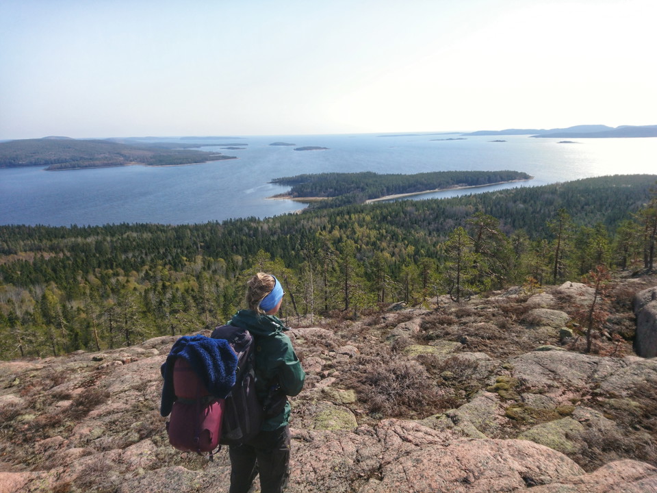
Leden går brant uppför och ger fin utsikt uppe på klipporna nära Tärnättvattnet. Foto: Johanna Öhrling, Länsstyrelsen
The cave trail between the coastal trail och Tärnättvattnet
- Hiking
- County: Västernorrlands län
- 6644.95 km away from you
Trail details
- Length 0.8 km
- Difficulty Black - experienced
Actions
Description
A very steep hiking trail between the coastal trail close to Tärnättholmarna and the smal lake of Tärnättvattnet.
Avoid in wet weather when the rocks are slippery.
If you want to take this trail its is much better going up (so you can use your hands) than down (hard on knees and feet and risk of falling).
The trail passes a cave.
Activities And Facilities
- Hiking
Contact
Email address
I’ve been here 14






I want to go here
Questions & Answers
Ask a question to other Naturkartan users.
Reviews
0 reviews
- 5 :
- 4 :
- 3 :
- 2 :
- 1 :
Users images
No user images yet. Be the first to share!
