
-
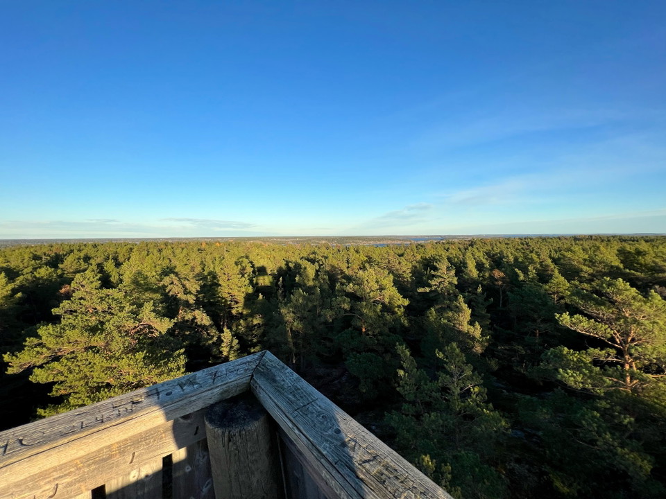
Utsikt från Telegrafbergets utkikstorn
Telegrafberget naturreservat
- Nature reserve
- Near Public Transport
- County: Stockholms län
Actions
Description
Activities And Facilities
- Nature reserve
Accessibility
- Near Public Transport
Facts
The name Telegraph Mountain comes from the fact that an optical telegraph station was located on top of the mountain for two periods in the 19th century. The telegraph station disappeared in the 1860s. Since 1987, however, there has been a lookout tower with a fantastic view of the entire Brevik peninsula and Tyresö archipelago. On clear days, visitors can see all the way to Stockholm city.
Parking
Parking spaces for visitors with cars are available at Trinntorpsbadet. The road to the tower is marked from Trinntorpsbadet.
Communications
Nearest bus stop: Trinntorp or Trinntorps bryggväg
Directions
Parking spaces for visitors with cars are available at Trinntorpsbadet. The road to the tower is marked from Trinntorpsbadet.
Almost opposite the descent to Tyresö brygga, Trinntorp, there is a path with a steep climb on the other side of Breviksvägen. Now you are inside the nature reserve.
It is a challenging climb and depending on how much it has rained, the path may have become very wet.
Follow the orange markings on the trees. When the climb levels out and a section of wetland appears on your left, you should soon turn right and head up again.
Now the path goes over rocks, but still with markings on the trees. Soon the path goes more south and you can glimpse the tower at the height of Telegrafberget.
Contact
Email address
Fritid- och friluftenheten
Organization logotype

Please be aware that some of these texts have been automatically translated.
I’ve been here 1
I want to go here 5

Questions & Answers
Ask a question to other Naturkartan users.
Reviews
—
0 reviews
- 5 :
- 4 :
- 3 :
- 2 :
- 1 :
Users images
No user images yet. Be the first to share!
