
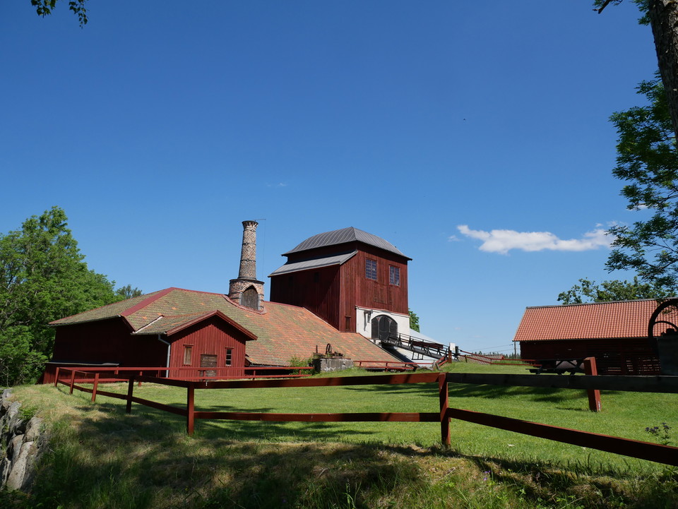
Stage 6 HAMMARBY – PERSHYTTAN
- Hiking
- County: Örebro län
- 6677.95 km away from you
Trail details
- Length 15.0 km
- Time 4 h
- Difficulty Blue - medium
Actions
Description
Activities And Facilities
- Hiking
Facts
Length: 15 km
Time: 4 h
Difficulty level: 2
Activities: Paddling, fishing, cycling, swimming
Conditions: Height difference - forest path and forest road.
Altitude: 92 m above sea level
Fresh water: At Hammarby village hall there is an outdoor tap for refilling fresh water. In Pershyttan there is a toilet with water. At Digerberget there is a tap at the clubhouse. 8-900 m. south of Hammarby is Kungshedens cold spring, clear water that seeps out of the bedrock. We cannot guarantee the quality of water in cold springs. You must make your own assessment and filter or boil the water if necessary.
Transportation:
Get off at the Bergslagsleden stop, where the trail crosses highway 244. You can also book local traffic between Nora and Pershyttan. You can also book local traffic to Hammarby from Nora.
https://www.lanstrafiken.se/reseplanering/flextrafik-och-nartrafik/nartrafik-i-orebro-lan/
Accommodation: Hammarby bygdegård
Directions
There are frequent bus services on highway 50. Get off at the Bergslagsleden stop, where the trail crosses highway 244. www.lanstrafiken.se
Downloads
Contact
Email address
Johan Karlström
Organization logotype

Please be aware that some of these texts have been automatically translated.
I’ve been here 21




I want to go here 46





Questions & Answers
Ask a question to other Naturkartan users.
Reviews
0 reviews
- 5 :
- 4 :
- 3 :
- 2 :
- 1 :
Users images
No user images yet. Be the first to share!
