
-
Geologistigen, Bispfors
Vandringsled Geologistigen, Bispgården
- Hiking
- Walking
- Running
- County: Jämtlands län
- 6569.35 km away from you
Trail details
- Length 3.9 km
- Difficulty Blue - medium
Actions
Description
As you walk the Geology Trail, you pass the different types of soil that together form a typical Norrland river valley. You will also have the opportunity to see how the distribution of the soil types controls the vegetation.
- Height difference: 119 m
- Starting point:** Hotel Älggårdsberget, Bispgården
See brochure available at the start!
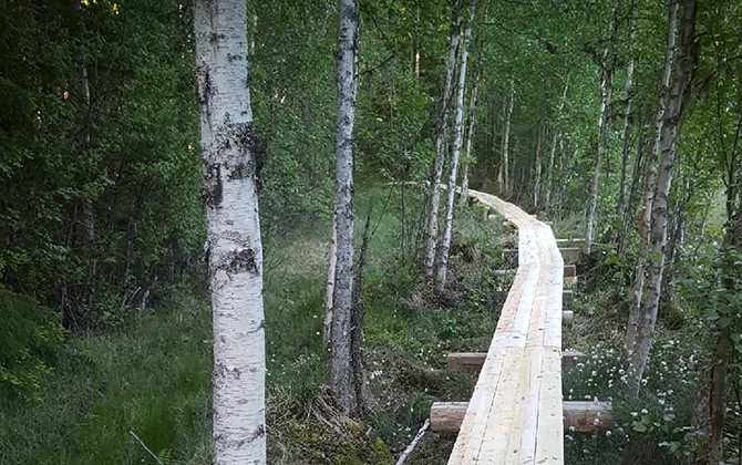
Follow the yellow markings. The path is well trodden and there are paths over Långmyran and over a stream. The trail starts with an arboretum (collection of trees). After a stretch along the pilgrim trail, the trail turns towards the slalom slope. The view from the top of the slope is magnificent. If you continue, you come to a detour to Löttjärnen. There are benches and a barbecue area. If you instead go straight ahead, the path goes over a power line street and then turns up towards Blomkvisttorpet.
The croft was inhabited not long ago and the child's school route partly follows this path. The path also crosses the highest coastline, where the sea once went. On the way back, hiking down the slalom slope is an option.
Don't miss it!
Löttjärnen, the highest coastline, the croft and the great view from the slalom slope.
Activities And Facilities
- Walking
- Running
- Hiking
Contact
Address
Ragunda kommun
0696-68 20 00
Email address
Ragundadalen
Please be aware that some of these texts have been automatically translated.
I’ve been here
I want to go here 8

Questions & Answers
Ask a question to other Naturkartan users.
Reviews
0 reviews
- 5 :
- 4 :
- 3 :
- 2 :
- 1 :
Users images
No user images yet. Be the first to share!
