Östergötlands län

Information

Map

283 Information

Information

Jonsbo/Ånestad, brant passage

  • Municipality: Ydre
  • 6784.56 km away from you

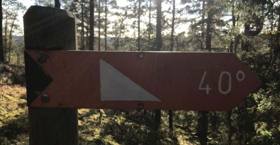
NOTE! Between Jonsbo and Ånestad there is a very steep passage with a 40 degree slope. If you want to walk more easily, you can follow Kisavägen from Ånestad to Jonsbo and walk the forest road up to the trail. (updated 2021-11-10/eb)
Information

Ny sträckning på Östgötaleden Sjöbo-Gripenberg i riktning mot Malexander

  • Municipality: Boxholm
  • 6766.60 km away from you

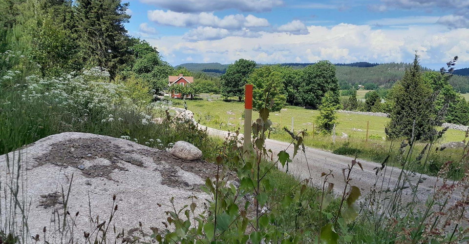
Now the trail goes along a beautiful gravel road, passing the farms in Skärlunda and the small village of Gripenberg. From here go the gravel road north. At the T-junction Skärlunda norrgård turn right, walk between the stone walls, see the nice view out ov…

Information

Ny sträckning på Östgötaleden Gripenberg-Sjöbo i riktning mot Sundsudden

  • Municipality: Boxholm
  • 6767.47 km away from you

Now the trail goes along a beautiful gravel road, passing the small village of Gripenberg and the farms in Skärlunda. From here go the gravel road north, you go right through the old village of Gripenberg. Eventually you come to Skärlunda södergård. Here yo…

Information

Strolången, klippa

  • Municipality: Valdemarsvik
  • 6813.66 km away from you

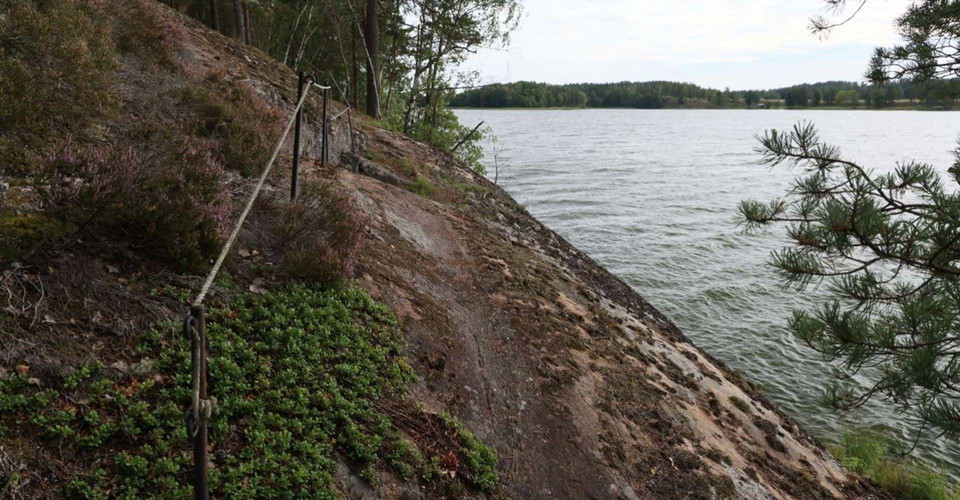
At Strolången, the path runs on a cliff that slopes towards the water and there are ropes as guides. (updated 2022-12-30/eb)

Information

E22, farlig korsning!

  • Municipality: Söderköping
  • 6804.44 km away from you

Here Östgötaleden crosses road E22. Be careful at this crossing! (updated 2023-02-20/eb)

Information

Saxtorp, smal passage på 70-väg

  • Municipality: Linköping
  • 6781.72 km away from you

Here the trail runs on a 70 road for about 600 m. At a rock wall the road is very narrow. Please be careful! (updated 2023-04-03/eb)

Information

Genväg mellan Rustninge och Mörkkullen

  • Municipality: Motala
  • 6719.11 km away from you

A shortcut for those who want to shorten the Västanvik loop and not walk past Medevi. The loop then becomes about 10 km. (updated 2023-06-26/eb)

Nature Center

Naturum Tåkern

  • Municipality: Ödeshög
  • 6731.41 km away from you

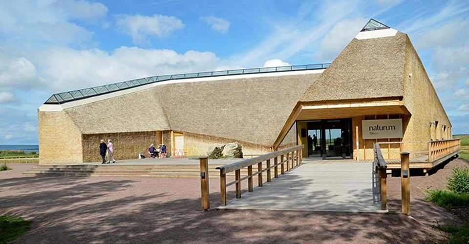
The Tåkern Nature Center is located by the lake of birds, a gateway to nature and culture in the Tåkern region. "Sweden's sharpest nature center" is a unique building, designed by Wingårdh architects and completely covered in reeds. Naturum Tåkern is owned…

Information

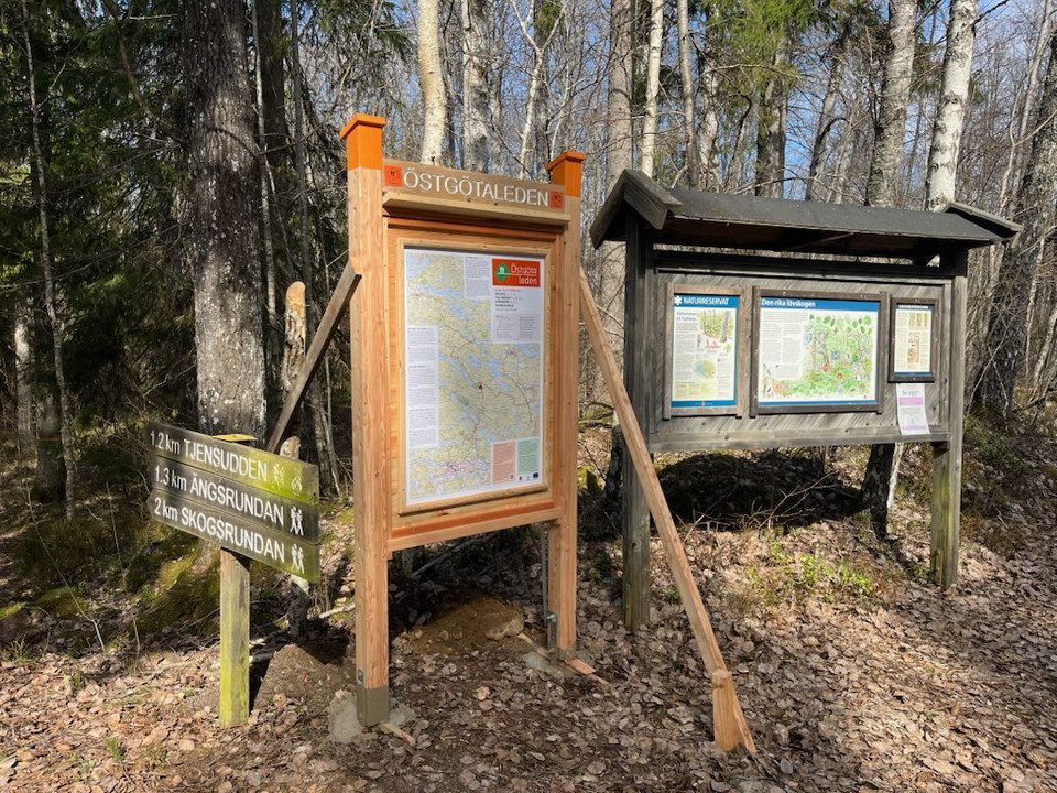
Vallaskogen, information om Östgötaleden

  • Municipality: Linköping
  • 6767.09 km away from you

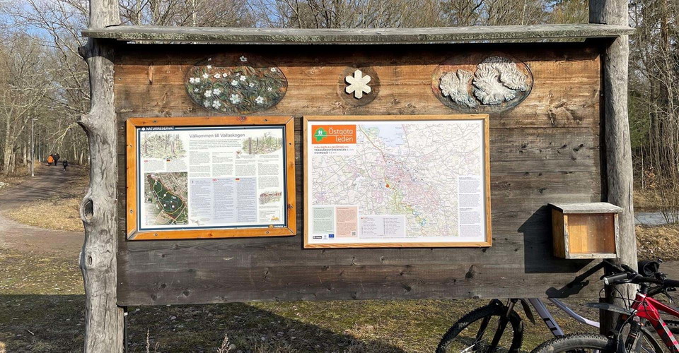
Near Valladammarna you will find an extra map with information about the Östgötleden stage Gamla Linköping - Trädgårdsföreningen. The board also contains information about the Vallaskogen nature area. (updated 2024-03-04/eb)

Attraction

Svämb bromiljö

  • Municipality: Ödeshög
  • 6727.61 km away from you

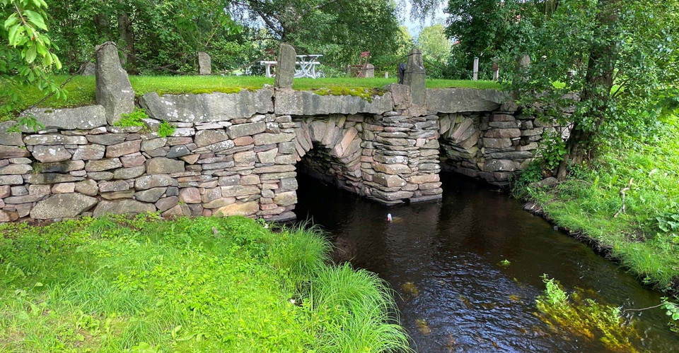
På denna plats har inte mindre än tre parallella broar över samma vattendrag kommit att finnas kvar. Miljön illustrerar på ett bra sätt resandets allt snabbare utveckling, särskilt under 1900-talet.Broarna har ingått i huvudleden Stockholm - Skåne som sedan…

Information

Gärdsnäs

  • Municipality: Åtvidaberg
  • 6813.73 km away from you

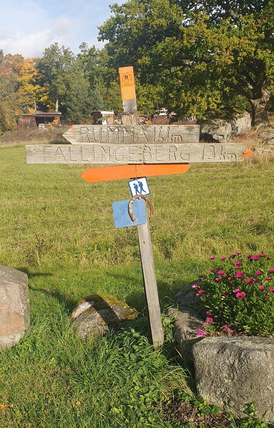
The Östgötaleden trail passes here, through Gärdsnäs village. 16km to Rumma and 13km to Fallingeberg

Entrance

Tjuttorp, startplats

  • Municipality: Finspång
  • 6757.60 km away from you

Tjuttorp acts as a hub for the Östgötaleden trail. From here you can choose to walk northwest towards Regna or east towards Falsnäset and on to Rejmyre. From Falsnäset you can continue your hike towards Sörsjön in Norrköping municipality. If you choose the…

Information

Vägval 1 till Gryt utsiktstorn

  • Municipality: Valdemarsvik
  • 6842.57 km away from you

Detta vägval är den kortaste vägen att följa upp till utkikstornet. Den går rakt upp för berget. Avståndet är 200 meter. Men stigningen är kraftig då du måste passera en ravin. Tidvis är denna passage lerig.

Information

Vägval 2 till Gryt utkikstorn

  • Municipality: Valdemarsvik
  • 6842.50 km away from you

Detta vägval är något lättare och går runt höjden. Avståndet är ca 450 meter. Stigningen är även här kraftig och stenig men man slipper den besvärliga ravinen, som är på den södra sidan om berget (från reservatsparkeringen).

Information

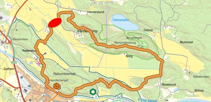
Avstängd del av etappen, spänger borttagna vid Vännerstorp!

  • Municipality: Söderköping
  • 6798.39 km away from you

Spången över gärdet vid Vännerstorp har tagits bort (se rött område). Vi ber därför alla som nyttjar leden att undvika gärdet där spången tidigare var placerad, med hänsyn till berörd markägare. En ny sträckning av leden kommer att märkas ut under hösten 2026.

Naturkartan

Open this in the app