


-
-
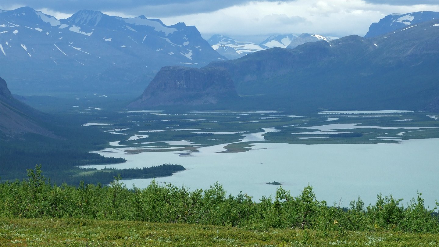
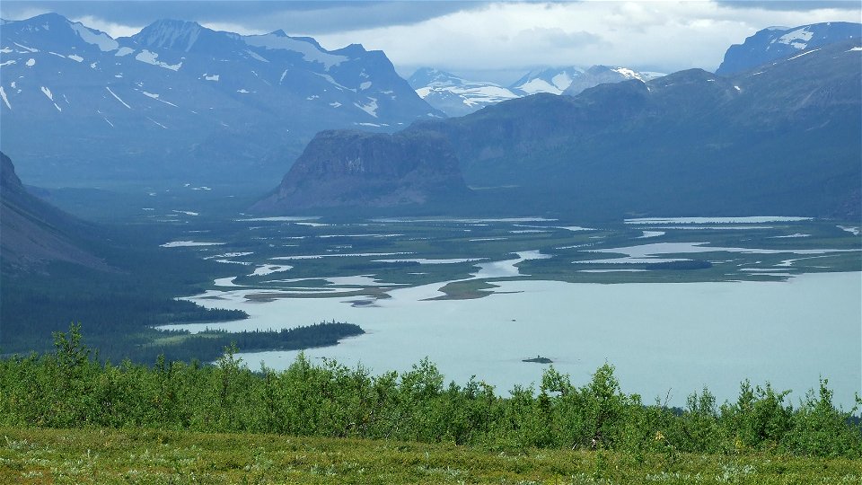
Gammelskog vid Jaurekaska i Ultevis.
Photo: Länsstyrelsen Norrbotten -

Ultevis fjällurskog
Nature reserve
- County: Norrbottens län
- 7580.89 km away from you
Actions
Description
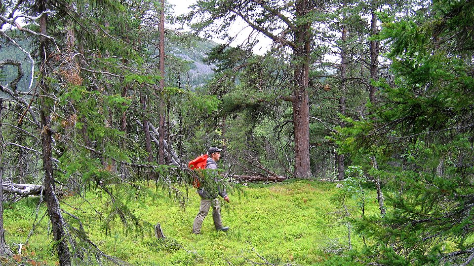
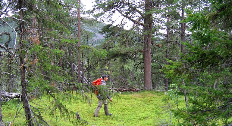
Ultevis is a roadless, large forest of centuries old pines, thick-growth old spruce and gnarled mountain birches. The forest surrounds the large, low mountain massif Ultevis. The whole area is 1,173 square kilometres in size.
Activities And Facilities
-
Nature reserve
Facts
Municipality: Jokkmokk
Year of formation: 2000
Size: 1173 square kilometers
Administrator: County Administrative Board
Form of protection: Nature reserve, Natura 2000
Communications
The nature reserve lies about 38 kilometres northwest of Jokkmokk and is reached via Kvikkjokksvägen or Sjöfallsvägen, for example from Saltoluokta or Björkudden (boat across Laŋgas/Stora Lulevatten). You can also reach the reserve from the road to Ålloluokta. The King’s Trail runs through Ultevis.
Directions
The nature reserve is located about 38 kilometers northwest of Jokkmokk and can be reached via Kvikkjokksvägen or Sjöfallsvägen, for example from Saltoluokta or Björkudden (boat over Langas/Stora Lulevatten). You can also reach the reserve from the road to Ålloluokta.
Regulations
All regulations can be found in the reserve decision. It is allowed to:
- camping
- hiking
- make a fire
- picking berries and edible mushrooms
- driving snowmobiles on well-snow-covered ground
- fishing and hunting in accordance with applicable laws
It is not allowed to harm plant and animal life. Remember the right of public access and protect nature!
Ultevi's mountain primeval forest consists of several older nature reserves and several domain reserves. The nature reserves have retained their regulations, read more in the decision.
Contact
Email address
Länsstyrelsen Norrbotten
Organization logotype
![]()
Please be aware that some of these texts have been automatically translated.
Questions & Answers
Ask a question to other Naturkartan users.
Reviews
You might also be interested in
