
-

Granlandet är ett vidsträckt och i hög grad opåverkat område. Samspelet mellan våtmarkerna och skogarna kan närmast liknas vid en mosaik.
Photo: Länsstyrelsen Norrbotten -

-

Gammelskog i Granlandet.
Photo: Länsstyrelsen Norrbotten -

Död ved finns det gott om, såväl liggande och stående och i alla nedbrytningsstadier. -

Granlandets skogar har naturliga strukturer såsom luckighet och åldersvariation. -

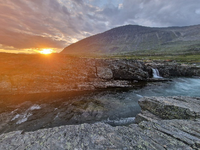
Flottning var aldrig ekonomiskt i Granlandet. Resultatet är att såväl vattendrag som skogar har bevarats från dess konsekvenser. Här i bild ses ett relativt opåverkat vattendrag. -

Granlandet har en lång historia av samisk markanvändning, vilket syns på en mängd sätt i området.
Granlandet
- Nature reserve
- County: Norrbottens län
Actions
Description
Granlandet is one of the largest roadless areas in the forests of Norrbotten. Here the pristine forest has remained untouched by forestry, so that primary forest birds, wildlife and plants can thrive, and nature can run its course year after year. There are a dozen different types of mire in the area. Many are wet and almost inaccessible. The landscape is hilly, with occasional higher areas. Kissalaki is the highest mountain, reaching about 490 metres. A couple of ridges run through Granlandet. The area is 272 square kilometres in size.
Activities And Facilities
- Nature reserve
Facts
Municipality: Gällivare
Year formed: 1997
Size: 272 square kilometers
Administrator: County Administrative Board
Form of protection: Nature reserve, Natura 2000
Communications
The nature reserve lies about 28 kilometres northwest of Murjek. The logging road Maisavaaravägen leads into the reserve from the road between Polcirkeln and Nattavaara village, however the road is in poor condition.
Directions
The nature reserve is located about 28 kilometers northeast of Murjek. The Maisavaara forest road leads into the reserve from the road between the Arctic Circle and Nattavaara village, the road is in poor condition.
Regulations
All regulations can be found in the reserve decision. It is allowed to:
- camping
- hiking
- make a fire
- picking berries and edible mushrooms
- drive snowmobiles on well-snow-covered ground
- fishing and hunting in accordance with applicable laws
It is not allowed to harm plant and animal life. Remember the right of public access and protect nature!
Contact
Email address
Länsstyrelsen Norrbotten
Organization logotype

Please be aware that some of these texts have been automatically translated.
I’ve been here 6

I want to go here 12

Questions & Answers
Ask a question to other Naturkartan users.
Reviews
0 reviews
- 5 :
- 4 :
- 3 :
- 2 :
- 1 :
Users images
No user images yet. Be the first to share!
