
-
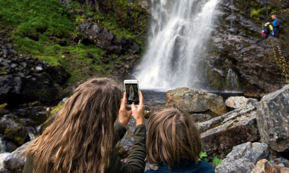
Photo: Destination Vemdalen
Fettjeåfallet
- Hiking
- County: Jämtlands län
- 6477.49 km away from you
Trail details
- Length 1.7 km
Actions
Description
With its 60-meter drop, Fettjeåfallet is one of our country's highest waterfalls and the area's most beautiful natural scenery. The hike there along the Fettjeån river is a great family experience along paths and stone steps. From the parking lot, walk towards the shelter and follow the trail upstream Fettjeån. The trail has been rehabilitated and paved by Nepalese Sherpas in recent years. You cross the river twice over bridges. After 2 kilometers you reach the mighty waterfall and a rest area with barbecue and toilet. You can continue past the rest area to the foot of the falls. Fettjeåfallet is a popular and well-visited excursion destination.
Activities And Facilities
- Hiking
Directions
Kör in mot Klövsjö skidområde och följ Börtnanvägen cirka 5 kilometer innan du når parkeringen.
Please be aware that some of these texts have been automatically translated.
I’ve been here 23


I want to go here 43



Questions & Answers
Ask a question to other Naturkartan users.
Reviews
1 review
- 5 :
- 4 :
- 3 :
- 2 :
- 1 :
Users images
No user images yet. Be the first to share!

Har varit och tittat på vattenfall i Sverige och detta är nog min favorit. Fin väg att gå mot fallet med magisk natur. Väl värt ett besök tycker jag.