
-
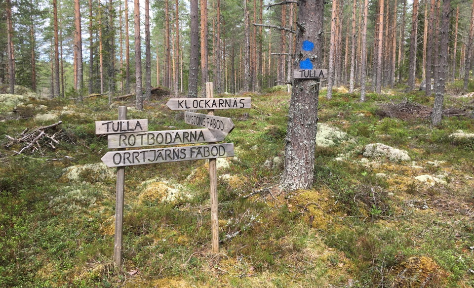
Ledkorset vid Tulla
Nysjöleden (Nysjöns fäbod-Tulla)
- Hiking
- Near parking
- County: Dalarnas län
- 6643.40 km away from you
Trail details
- Length 3.5 km
Actions
Description
The trail between Nysjöns fäbod and Tulla is an old fäbodstig that was used by the maids when the animals went out into the forest, but it was also used extensively on Sundays after the "stubble" when the fäbod litters had a few hours off. Then they gathered from Nysjön, Orrtjärn and Rotbodarna at a place near Övre Gammelbergstjärn called Tulla, where the paths met.
On the way you pass between Gruvberget and Gammelberget and there is BackOlles botten. It is a coal bottom, which is the remains of an old coal mine. Before Allrik's hermitage at Söthålsån you can stop at Lushavet. A nice pond that is often dry during summer and fall.
From Tulla you can continue north on Sommarvägen to Rotbodarnas fäbod or west to Orrtjärns fäbod.
The trail is marked with blue color and is managed by the association Räv-Lenas vänner.
Activities And Facilities
- Hiking
Accessibility
- Near parking
Directions
Drive to Linghed via Svärdsjö. Cross the bridge in Linghed and turn right at the crest. Drive on and turn left at the sign Nysjön. There is a parking lot for visitors in Nysjön's shed.
Downloads
Contact
Email address
Kontaktcenter Falu kommun
Organization logotype

Please be aware that some of these texts have been automatically translated.
I’ve been here 1

I want to go here 3

Questions & Answers
Ask a question to other Naturkartan users.
Reviews
0 reviews
- 5 :
- 4 :
- 3 :
- 2 :
- 1 :
Users images
No user images yet. Be the first to share!
