
-
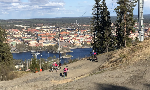
Photo: Jens Tirén
GB-banan downhill
- Mountainbiking
- Biking
- Near parking
- Near Public Transport
- County: Jämtlands län
- 6467.93 km away from you
Trail details
- Length 1.0 km
- Difficulty Blue - medium
Actions
Description
The GB course is made for everyone. From the absolute beginner and children to the more experienced downhill cyclists. It is built entirely with an excavator, which means that there are no roots or large stones to worry about. All jumps can be rolled over if you are not keen on jumping.
Activities And Facilities
- Mountainbiking
- Biking
Accessibility
- Near parking
- Near Public Transport
Facts
The cycle paths on Östberget are maintained by Östersund municipality. Remember to show consideration for other road users. The slopes of Östberget are popular for both walking and running.
Hills
Height difference: 62 meters from top to bottom.
Contact
Address
Kultur- och fritidsförvaltningen Box 705 831 28 Östersund
Email address
Jens Tirén
Organization logotype

Please be aware that some of these texts have been automatically translated.
I’ve been here
I want to go here
Questions & Answers
Ask a question to other Naturkartan users.
Reviews
0 reviews
- 5 :
- 4 :
- 3 :
- 2 :
- 1 :
Users images
No user images yet. Be the first to share!
