
Dalhemsån Hiking Trail
- Hiking
- County: Gotlands län
Trail details
- Length 2.2 km
- Difficulty Green - simple
Actions
Description
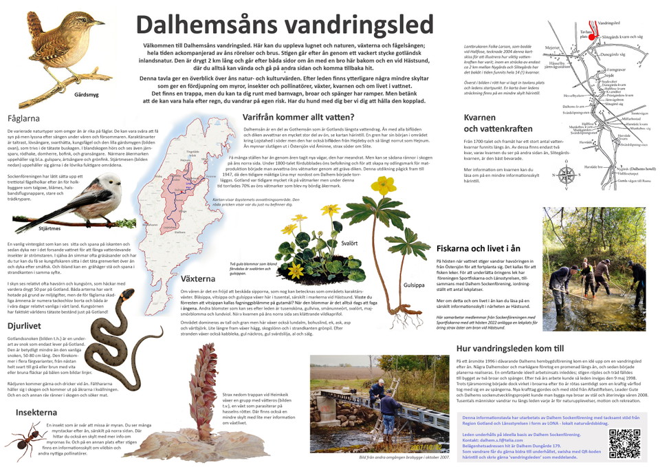
A hiking trail has been prepared along the Dalhemsån River. You can find the trail if you drive from Dalhems church south through the community for about 1 km. Just before the river there is a sign with a hiking trail.
Drive down to the parking lot, from there your hike down to Hästsund begins, the path follows the Dalhemsån River, about 1.1 km.
You can also take the bus to the bus stop at the Railway Museum (line 41), from where you can easily reach the hiking trail.
At Hästsund we have prepared a picnic area with barbecue facilities, so please bring a picnic basket. If you want, you can cross the footbridge and walk on the other side of the river back to the parking lot.
Remember to keep your dog on a leash during your visit.
NOTE: The path is not marked but easy to follow
Activities And Facilities
- Hiking
Contact
Email address
Turistbyrån på Gotland
Please be aware that some of these texts have been automatically translated.
I’ve been here
I want to go here 2

Questions & Answers
Ask a question to other Naturkartan users.
Reviews
0 reviews
- 5 :
- 4 :
- 3 :
- 2 :
- 1 :
Users images
No user images yet. Be the first to share!
