
-
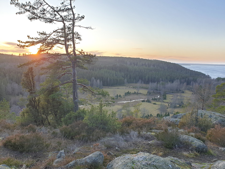
Vy över Tisaren - foto: Länsstyrelsen Örebro
Skåle klint
- Hiking
- Firesite
- County: Örebro län
- 6714.95 km away from you
Actions
Description
Skåle Nature Reserve is characterized primarily by its dramatic landscapes. Here you can see clear traces of the inland ice and the ancient sea in the form of shingle fields. From the Skåleklint hilltop you have an impressive view of Lake Tisaren and the surrounding woodlands. The damp hollows are home to a rich and varied plant life. A large number of mine holes in the area tell of the area's long history of mining. There are several hiking trails to explore in the area.
Activities And Facilities
- Hiking
- Firesite
Contact
Address
Besök vår webb visitaskersund.se
Email address
VisitAskersund Turistinformation
Organization logotype

Please be aware that some of these texts have been automatically translated.
I’ve been here 8

I want to go here 29





Questions & Answers
Ask a question to other Naturkartan users.
Reviews
1 review
- 5 :
- 4 :
- 3 :
- 2 :
- 1 :
Users images
No user images yet. Be the first to share!

Hur lång är vandringsleden Skåleklint