
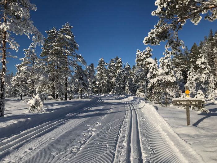
Ljungåsen's outdoor recreation area
- Skiing
- Shelter
- Firesite
- Toilet
- Parking
- Children's adventure
- Sledding hill
- County: Dalarnas län
- 6640.30 km away from you
Actions
Description
The outdoor area is set in stunning natural surroundings and offers cross-country ski trails for both classic and skate skiing. With distances ranging from 0.8 - 8 km, the area provides varied trails with different levels of difficulty and good accessibility.
Length: 0.8–8 km.
Difficulty: Easy to difficult.
Starting point: Parking area.
Trail marking: Color-coded by length.
Trail description: Barnspåret (0.8 km) and Myrspåret (3 km) are easy. Ljungåsspåret (2.8 km) is slightly hilly. Solspåret (3 km) and Hundspåret (4 km) are of medium difficulty. Vindkraftspåret (8 km) is difficult. All trails are generally prepared for both classic and skate skiing.
Changing rooms are open daily during the winter season between 08:00 and 17:00. There is a large parking area at Ljungåsen.
Trail conditions are affected by weather and snow levels, so please check the track status before your visit.
The trails are maintained by Ludvika Municipality.
Activities And Facilities
- Skiing
- Shelter
- Firesite
- Toilet
- Parking
- Children's adventure
- Sledding hill
Facts
- Ludvika kommun
- Phone +46 240 860 00
Directions
Directions from central Ludvika, distance 20 km:Take road 50 south, turn towards Gonäs, by taking road Lyviksvägen towards Gonäsvägen. Follow Gonäsvägen and Blötbergsvägen towards Björnhyttan/Grängesberg. At the three-roads crossing, turn left towards Grängesberg. After about 500 m turn right, there is a sign ”Ljungåsen 9 km”.
Please be aware that some of these texts have been automatically translated.
I’ve been here
I want to go here
Questions & Answers
Ask a question to other Naturkartan users.
Reviews
0 reviews
- 5 :
- 4 :
- 3 :
- 2 :
- 1 :
Users images
No user images yet. Be the first to share!
