
-
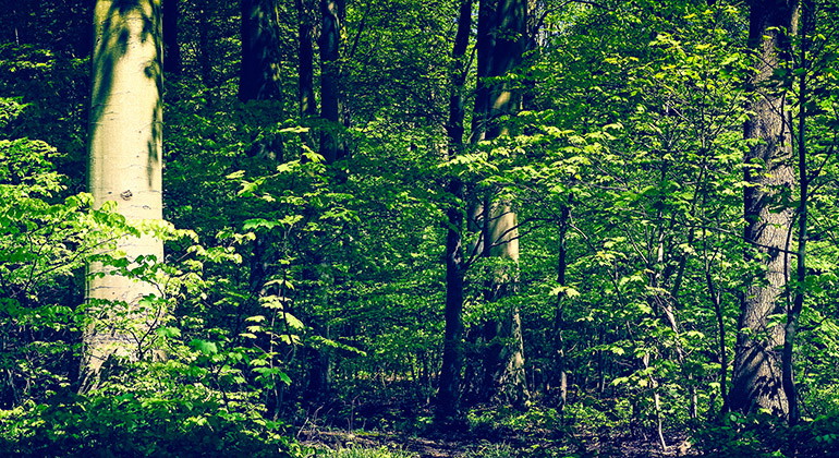
Skog.
Photo: Mostphotos
Verkeån, del II:2 Blästorp, Naturreservat
- Nature reserve
- County: Skåne län
Actions
Description
Experience the history of the landscape in Blästorp Nature Reserve. Hörrödsåsen, a pebble ridge whose gravel has created heights and hills, is a memory of the last ice age 15,000 years ago. Where the ice remained for the longest time, peat-covered depressions have formed.
On Skåne's largest pebble ridge
Hörrödsåsen, also known as Jären, is the largest pebble ridge in eastern Skåne and runs north-south from Agusa down towards Andrarum. Blästorp with its gentle hills is located in the southern part of this goat ridge. The old agricultural landscape's patchwork of small fields, pastures and forest groves also remains in the area.
In the Verkeån valley
Together with the much larger nature reserves Verkeån I Link to another website. and Verkeån Agusa-Hallamölla Link to another website., Blästorp protects the broadleaf forest and cultural landscape on the south-eastern slope of Linderödsåsen and along the Verkeån valley.
Outdoor life
The area currently has no marked paths. Just west of the nature reserve runs Skåneleden SL4, "Österlenleden". There are several hiking opportunities in the nearby reserves Verkeån Agusa-Hallamölla and Verkeån I. Remember to take your rubbish home.
In English
Welcome to Verkeån-Blästorp
The Hörrödsåsen ridge, an esker with gravel deposits creating plateaus and hills, stands as a reminder of the last Ice Age, some 15 000 years ago. Where the ice remained the longest, peat-covered hollows have formed. Hörrödsåsen, also known as Jären, is the largest esker in eastern Skåne. It runs in a north-south direction, from Agusa down to Andrarum. Blästorp with its soft hills is situated in the southern part of this sharp-crested ridge. The agricultural landscape, forming a patchwork of small fields, pastures and copses, also remains in the reserve.
Together with the significantly larger nature reserves Verkeån I and Verkeån Agusa- Hallamölla, Blästorp protects the broad-leaved deciduous forest and the cultural landscape on the south-eastern slope of the Linderödsåsen ridge and along the valley of the river Verkeån.
There are currently no marked trails in the area. The Skåneleden Trail SL4, "Österlenleden", passes just west of the nature reserve.
Regulations
Within the reserve it is forbidden to:
- put up notice boards, placards, posters, signs, or similar, or make inscriptions,
- dig up or pick flowers or in any other way damage vegetation,
- camp, park caravans or any other vehicles,
- in a disturbing manner use radios, music players or similar,
- drive motorized vehicles. The landowner or tenant farmer may, however, use tractors and motorized equipment in connection with farming or forestry.
- damage land, fencing or other facilities,
- light fires,
- bring unleashed dogs,
- carry out scientific or other investigations which may disturb the natural environment. However, the County Administrative Board may approve such investigations.
Activities And Facilities
- Nature reserve
Facts
Established: 1989
Size: 15 hectares
Municipality: Tomelilla
Manager: County Administrative Board of Skåne
Protection type: Nature reserve and Natura 2000
Directions
Walk, cycle, take public transport or drive here. Map and directions via Google maps or coordinates (WGS84).
Regulations
**Within the area, special rules and restrictions apply to the right of public access.
For example, it is forbidden to:
- keeping a dog unleashed
- make fires
- camping
- setting up a caravan/mobile home
- disturb the surroundings
It is important to note that this is only a selection of the rules.
Full regulations for visitors
In addition to regulations and prohibitions in other laws and regulations, it is forbidden to:
- affix any board, placard, poster, sign, inscription or similar device,
- digging up or picking flowers or otherwise damaging vegetation
- camping, setting up a caravan or parking,
- use a radio, gramophone, tape recorder or similar in a disruptive manner,
- drive a motorized vehicle. However, the landowner or agricultural tenant may use tractors and motorized tools in connection with agriculture and forestry.
- damage land or fences or other structures
- start a fire
- carry an unleashed dog
- carry out scientific or other studies that may disturb the natural environment, however, the county administrative board may authorize such studies
Contact
Address
Under LÄNKAR kommer du till aktuell reservatssida på Länsstyrelsens webbplats, med fördjupande information som kartor, broschyrer och hänvisning till relevanta aktörer. Här finns även en rapportfunktion för dig som vill lämna uppgifter om naturreservaten som vi förvaltar.
Email address
Organization logotype

Please be aware that some of these texts have been automatically translated.
I’ve been here
I want to go here
Questions & Answers
Ask a question to other Naturkartan users.
Reviews
0 reviews
- 5 :
- 4 :
- 3 :
- 2 :
- 1 :
Users images
No user images yet. Be the first to share!
