
-
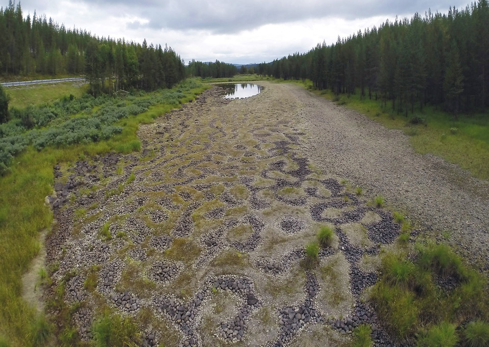
Photo: Bertil Hagberg -
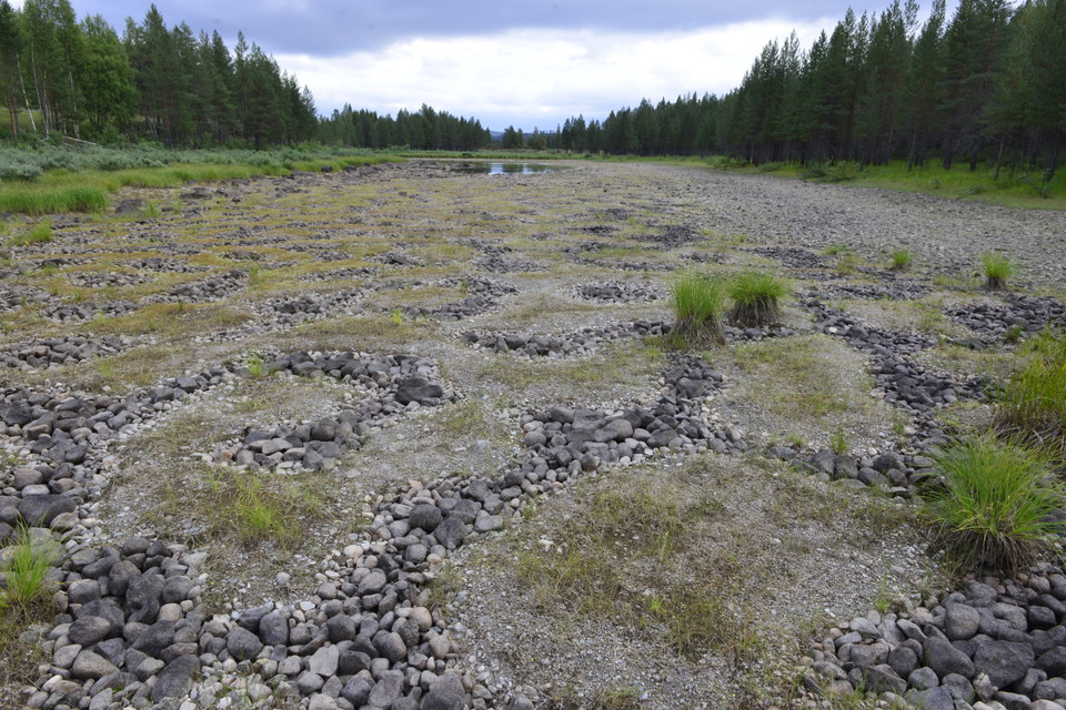
Photo: Bertil Hagberg
Stenringsavan
- Nature reserve
- Near parking
- County: Västerbottens län
Actions
Description
Rings on the water.
In the late summer, at low tide, they appear. A pattern of circles. Not on the water, but under, on the bottom.
How the rings got there is probably a question people asked themselves for many years after migrating into the area around Stenringsavan. They probably thought that they were a man-made structure of carefully arranged rings. Now we know the answer. Frost and thawing have lifted the stones out of the ground. Small stones and gravel have rolled down in the middle and the large stones have been left around the outside. But the way they are lying means they definitely look like relics left by people.
The best time
Stenringsavan is an area of shallows that dries out at low tide. The shallows are only linked to the Vindelälven river via a brook. The variations in the water level in the river therefore also affect the water level in the shallows. The best time to see the rings is in the autumn when the water level is low.
Human traces
There are also traces of human activity in the area. At the outlet into the river, there is an old hay meadow that floods in the spring. The land receives a little extra nutrition at this time, and it used to provide plenty of hay for the farmers who lived along Vindelälven river.
Activities And Facilities
- Nature reserve
Accessibility
- Near parking
Directions
The Stenringsavan nature reserve is located beside the Vindelälven river, by Route 363 (Vindelälvsvägen), 5 km upstream from Björksele. From the road, you have a view over the entire area.
Contact
Email address
Länsstyrelsen Västerbotten
Organization logotype

Please be aware that some of these texts have been automatically translated.
I’ve been here 5

I want to go here 10

Questions & Answers
Ask a question to other Naturkartan users.
Reviews
0 reviews
- 5 :
- 4 :
- 3 :
- 2 :
- 1 :
Users images
No user images yet. Be the first to share!
