


Sigfrid Trail
- Hiking
- Mountainbiking
- Trail running
- County: Kronobergs län
- 6793.47 km away from you
Trail details
- Length 102.0 km
- Difficulty Blue — medium
Actions
Description
Activities And Facilities
- Mountainbiking
- Hiking
- Trail running
Facts
In the fall of 2024, 25 stage entrance signs and 7 signposts were installed along the hiking trail. 3 new shelters have been built at Tjusås, Sandvik and Stocke bathing place. All innovations facilitate logistics for overnight stays and access to trail information along the hiking trail. The project has been financed with support from Tillväxtverket.
Surface
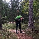
Mix of trail, gravel roads and some short parts on asphalt roads.
Hills
In the south mostly flat, up north more hilly parts.
Directions
Start your hike from Växjö Cathedral, Evedal, at Notteryd Nature Reserve or anywhere along the nature trail.
Downloads
Contact
Address
Telefon 0470-410 00
Email address
Kontaktcenter
Organization logotype

Please be aware that some of these texts have been automatically translated.
I’ve been here 10





I want to go here 41






Reviews
3.8
1 review
- 5 :
- 4 :
- 3 :
- 2 :
- 1 :
Questions & Answers
Ask a question to other Naturkartan users.
Users images
Share your photos of the place!

Definitionen av "lite asfalt" hade varit bra att veta innan man gick den. Många kilometer asfalt :(