
-

Gammal blå ledfärg är sedan 2020 bytt till orange.
Photo: P.O Alderback -
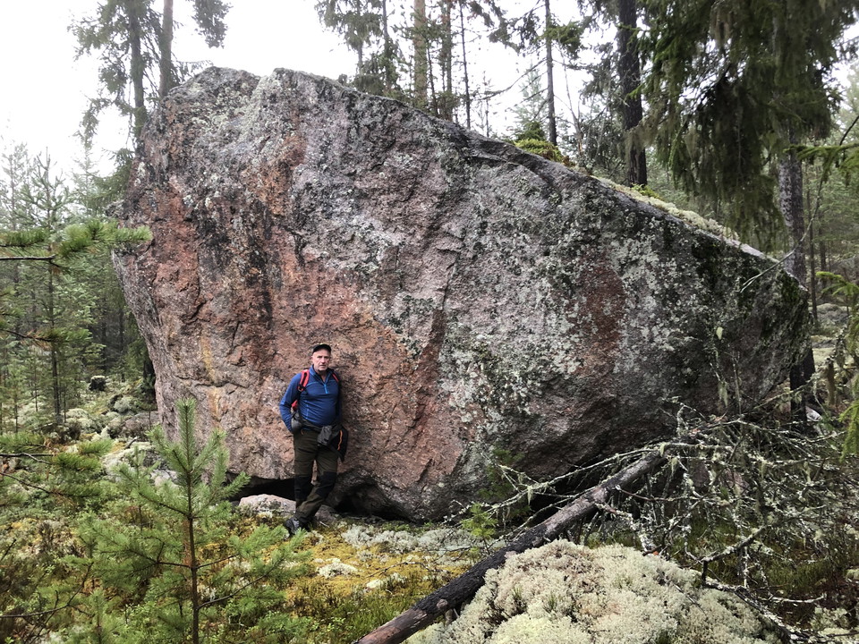
Photo: P.O Alderback
Pilgrimsleden
- Hiking
- Riding
- Trail running
- County: Dalarnas län
- 6637.33 km away from you
Trail details
- Length 23.0 km
Actions
Currently
Due to the storm Johannes, there are many trees lying over the trail and it may take some time before it is fixed and the trail is passable again. If you still choose to walk in the area - watch out for fallen trees, leaning trunks, hanging branches and other signs of instability in the forest.
Description
Activities And Facilities
- Hiking
- Riding
- Trail running
Directions
Starting point Kurbergets fäbodar (14.5 km): Drive RV 50 from Falun towards Söderhamn. In Övertänger, pass the village farm on the right and turn right at the sign Kurbergets fäbodar. After the last farm on the right, turn right. The trail starts at the sign in the middle of Kurbergets fäbodar.
Starting point Yttertänger (23 km): Turn right at the sign Mek Verkstad. Drive over the bridge and about 500 m to the sign Ridled.
Downloads
Contact
Email address
Kontaktcenter Falu kommun
Organization logotype

Please be aware that some of these texts have been automatically translated.
I’ve been here 3

I want to go here 13

Questions & Answers
Ask a question to other Naturkartan users.
Reviews
1 review
- 5 :
- 4 :
- 3 :
- 2 :
- 1 :
Users images
No user images yet. Be the first to share!

Väldigt bra uppmärkt ! Fina stigar o skog!