New!

Now you can share photos on Naturkartan! 📸

Read more

Best hiking trails in Västmanlands län

Västmanlands län

Naturkartan samlar de vandringslederna i Västmanlands län som är populärast bland våra användare.

Images

Map

189 Best hiking trails in Västmanlands län

Hiking

Arboga — Tjurlångsleden trail

  • Municipality: Arboga
  • 6722.02 km away from you
  • 10.0 km
  • 3 h

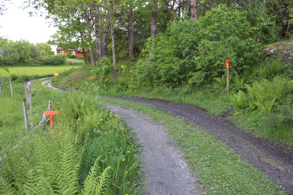
The Tjurlångsleden trail is a 10 km long hiking trail that takes you through various forest landscapes around Lake Tjurlången outside Arboga. You spend the entire route near the water and the chance to see birds and other wildlife is great. You can find cle…

Hiking

Sala — Gruvdammsrundan trail

  • Municipality: Sala
  • 6726.21 km away from you
  • 26.0 km

The Gruvdammsrundan trail is a lakeside, family-friendly hiking route that begins and ends in the historic mining town of Sala. The trail takes you through soothing forests, over fields of restful moss, and along several lakes ideal for swimming and fishing…

Hiking

Utörundan

  • Municipality: Västerås
  • 6766.85 km away from you
  • 8.5 km

Utörundan has two alternative routes that are 7.5 or 8.5 kilometers long. Utörundan starts from the parking lot at Ängsö Castle or at Långholm's jetty. Follow the signs and orange markings along the trail. Utörundan has partly the same route as Bryggrundan…

Hiking

Billingens naturstig

  • Municipality: Köping
  • 6738.07 km away from you
  • 4.8 km

The trail is 4.8 kilometers long and winds through a large cow pasture. The path is marked with orange paint on trees, posts and arrows. Along the path there are 13 signs on which you can read about the nature and history of Billingen. The first 300 meters…

Hiking

Fagersta — Landsbergstriangeln (the Landsberg Triangle)

  • Municipality: Fagersta
  • 6696.55 km away from you
  • 16.0 km
  • Difficulty: Red

Caves from the ice age, dreamy forests, and magnificent views The very popular Landsbergstriangeln (the Landsberg Triangle) hiking trail is a 16-km route that includes sections of the famous (and much longer) Bruksleden hiking trail. It leads through a drea…

Hiking

Skinnskatteberg — the Ormdalslingan trail

  • Municipality: Skinnskatteberg
  • 6680.95 km away from you
  • 5.8 km
  • 2 h
  • Difficulty: Red

The Ormdalsslingan trail outside Skinnskatteberg is a 5.8 km long hiking trail that offers a walk of varied beauty through fairy-tale-like forests. The trail takes you through the scenic Baggådalen valley and the Ormdalen valley nature reserve. Along the wa…

Hiking

Arboga — Säterboleden trail

  • Municipality: Arboga
  • 6729.35 km away from you
  • 12.0 km
  • 4 h 30 min

The Säterboleden trail is a beautiful hiking route outside the city of Arboga that begins and ends at Hjälmare dock, a popular summer destination. At Hjälmare dock, you'll find toilet and shower facilities, spots for motorhomes and caravans, and a café open…

Hiking

Prästgårdsrundan

  • Municipality: Västerås
  • 5.5 km

Prästgårdsrundan gives you a tour of about 5.5 kilometers in mixed terrain. The trail is marked with orange color on poles and trees. The trail largely follows the old road to Berg. At Berg there is a Cultural Trail that runs through the old agricultural la…

Hiking

Lilla och stora Askörundan, Asköviken-Tidö

  • Municipality: Västerås
  • 6747.57 km away from you
  • 6.8 km

From the parking lot at Askö there are two loops, Lilla Askörundan 3.3 kilometers and Stora Askörundan 6.8 kilometers. Parts of the loops are on forest paths, parts on roads and gravel paths and sometimes through pastures with grazing cows. The loops are ma…

Hiking

Vandringsled, Djurgårdsskogen

  • Municipality: Hallstahammar
  • 6738.08 km away from you
  • 4.0 km

Here you can choose between three loops, Björkstigen 1 km (blue marking), Ekstigen 2.5 km (red marking) and Granstigen 4 km (yellow marking).

Hiking

Vandringsled, Jordmarken

  • Municipality: Västerås
  • 6738.50 km away from you
  • 5.5 km

Here you can walk in the forest and cow pasture among really old oaks where the flowers are great and the butterflies flutter past. The trails are marked with orange color. The trail system is a total of about 4.5 kilometers long, there are also some gravel…

Hiking

Vandringsled, Badelunda

  • Municipality: Västerås
  • 6748.85 km away from you
  • 2.7 km

In Badelunda nature reserve there are various paths and small roads to walk around on. They are part of the system of paths in Badelunda and at Anundshög. For example, part of the Badelunda fornstig trail runs through the nature reserve. There are informati…

Hiking

Tjärnrundan

  • Municipality: Västerås
  • 6764.71 km away from you
  • 5.0 km

Tjärnrundan is a hiking trail that is just under 5 kilometers long. It starts at the parking lot by the bridge over to Ängsö. The path is narrow and goes over stones, roots and rocks. A shorter part is on gravel roads. When it has rained, the trail can be m…

Hiking

Brandstigen

  • Municipality: Surahammar
  • 6717.69 km away from you
  • 3.3 km

Brandstigen är en cirka 3,5 kilometer lång promenad utöver det vanliga! Du får en vandring över stock och sten, bokstavligen, och du kan få klättra över brända stockar för att ta dig fram. Håll även ögonen öppna efter brandslang som ligger kvar på några pla…

Hiking

Vandringsled, Klackberg

  • Municipality: Norberg
  • 6689.63 km away from you
  • 3.6 km

There are three trails of different lengths, Barnvagnsvägen (1.6 kilometers), Svåra vägen (1.3 kilometers) and Långa vägen (1.8 kilometers). You can also walk around the ski tracks when there is no snow. There are several signs around the area pointing out…

Best hiking trails in Västmanlands län

Naturkartan samlar de vandringslederna i Västmanlands län som är populärast bland våra användare.

Naturkartan

Open this in the app