-
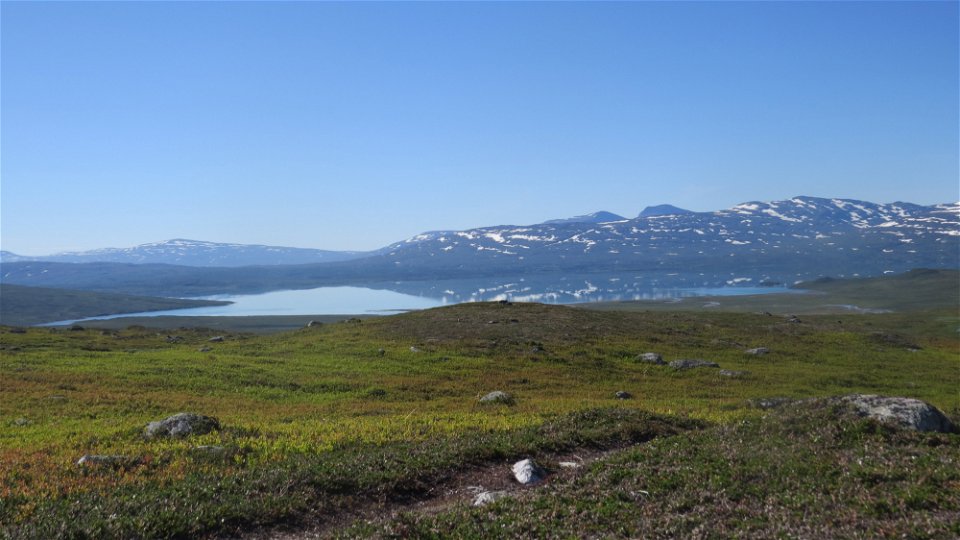
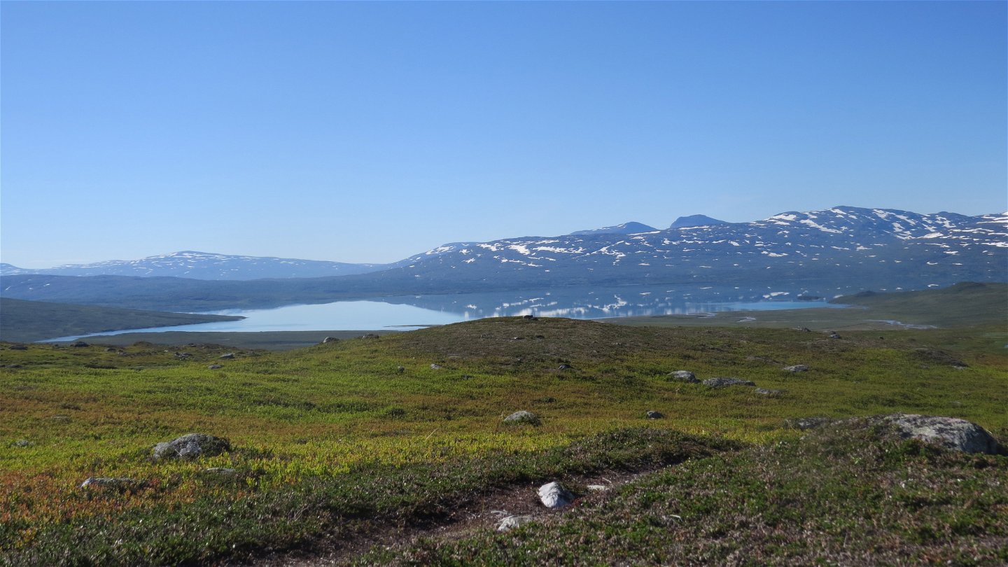
Bieskehávrre.
Photo: Henrik Micael Kuhmunen/Laponiatjuottjudus

Pieskehaure-Darreädno, The Arctic Trail
Hiking
- County: Länsstyrelsen Norrbottens län
- 7564.52 km away from you
Trail details
- Length 40.0 km
Actions
Description
Pieskehaure-Vaimok, 20 km
The tour begins with a gentle upward slope across mountain moor on the slopes of Dälbut mountain. The trail passes a ford that is usually easy to wade and then continues across a grassy plateau. The trail gains altitude as it approaches the mountain spur Muorannjunnje. It becomes increasingly barren and rocky. You round the mountain Vistek and into view come Lake Vájmok and Stájggá mountain. There is a steep descent to the bridge in Vájmokvágge Valley, then a steep climb followed by a descent across the round, steep Vájmokbákte mountain on boulder-strewn ground. After an easy wade you arrive at the cabin.
There are good tent pitches on the grassy moors a few kilometres east of the Pieskehaure cabin. Apart from that, it is difficult to find good sites to make camp in the rocky environment along trail. But you can find places here and there.
Duration: 6-8 hours
Vaimok-Darreädno, 20 km
The trail initially follows the shore of the crystal-clear Lake Vájmok. It is a barren landscape with a surface that varies between stones, boulders, moor and plankways. After a few kilometres, the trail departs from the lake and continues below the steep slopes of Juovvabuollda mountain and on into Gurávágge Valley. About 10 km from the Vaimok cabin, you pass Kurajaure stopover cabin, which is beautifully situated with a view of the imposing mountain Stájggá. The hike continues along well-trampled paths and crosses wet parts via plankways. Then a long downward slope begins into the verdant Tarradalen Valley. The view of the Tarrekaise massif and Lake Tarraure is magnificent. The trail is steep as it continues through birch forest. Just before Darreädno River, a path turns off to the right heading for the Tarraälv riverside shack. The trail crosses Darreädno River via a suspension bridge. What remains is a 1 km stretch through dense birch forest leading to the Padjelanta Trail.
There are good tent pitches, for example at Kurajaure stopover cabin and at the bridge across Darreädno.
Duration: 6-8 hours
Activities And Facilities
-
Hiking
Surface
Pieskehaure-Vaimok: at lower altitude, easily-hiked brush- and grass-covered moor. With increasing altitude it becomes more and more barren, covered with rocks and boulders.
Vaimok-Darreädno: boulder-strewn and rocky ground initially. Then easily-hiked moorland and plankway stretches in Gurávagge Valley, with dense undergrowth in Tarradalen Valley.
Contact
Email address
Länsstyrelsen Norrbotten
Organization logotype
![]()
Questions & Answers
Ask a question to other Naturkartan users.