

Duolbanjunni-Hukejaure, The Arctic Trail
Hiking
- County: Länsstyrelsen Norrbottens län
- 6370.14 km away from you
Trail details
- Length 17.0 km
Actions
Description
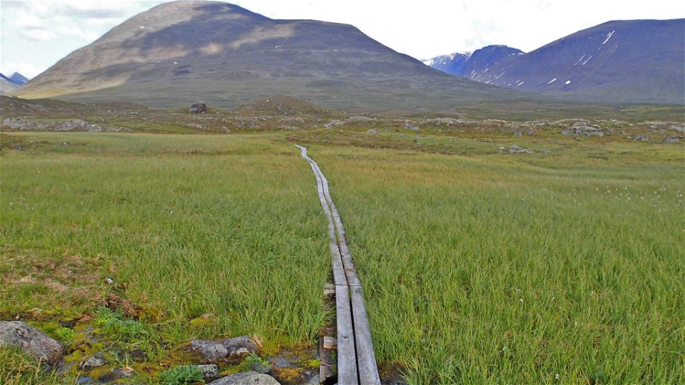
The trail turns off the King’s Trail at the meditation site west of Duolbanjunni mountain. The trail leads down to Tjäktjajåkka stream and across a suspension bridge. A distinct trail, partly provided with plankways, then continues up across scree towards the verdant, narrow, canyon-like Čuhčavággi valley. The hike crosses grassy pastures and is easy. However, in places the trail can be indistinct and difficult to follow. The trail continues alongside lakes Vuolimus, Gaskkamus and Bajimus Čuhčajávri. At the second of these lakes there is a fine view of the Kebnekaise massif. Soon after that lake, the trail crosses a stream. The ford is wide and wading is usually easy. After the wade, the terrain becomes hillier and has less variety of species. The low fell Ráktas is rounded and the hike continues towards Lake Huvkijávri. The last part is easy to hike and the trail is clearly marked with cairns.
There are many good tent pitches along the trail stretch.
Duration: 5,5-7 hours
Activities And Facilities
-
Hiking
Surface
Easily-hiked. Meadow-like vegetation and small differences in altitude in the valley. Slightly hilly terrain after the middle of the three lakes.
Contact
Email address
Länsstyrelsen Norrbotten
Organization logotype
![]()
Questions & Answers
Ask a question to other Naturkartan users.