Rönne å och Ringsjön


Arvokas luonto
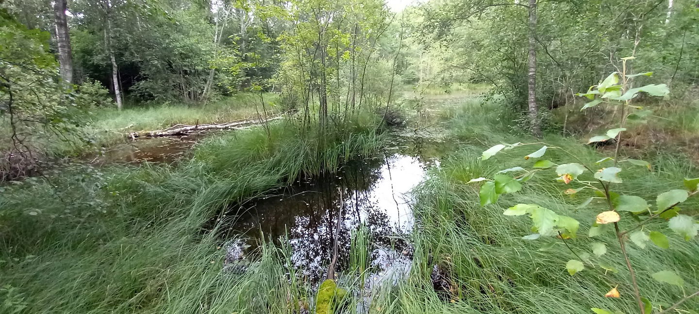
Räfshalen, which means "fox tail", is a meadow located just north of Lake Bandsjön at Riseberga.
The outfield can be likened to a large heath or meadow in which the local farmers let their animals graze.
In summer, the meadow is an Eldorado for butterfly lovers as more than half of Skåne's butterfly species are resident in the meadow. On a sunny day in June-July, Räfshalen offers an unforgettable experience when the whole meadow flutters with butterfly wings in all the colors of the rainbow.
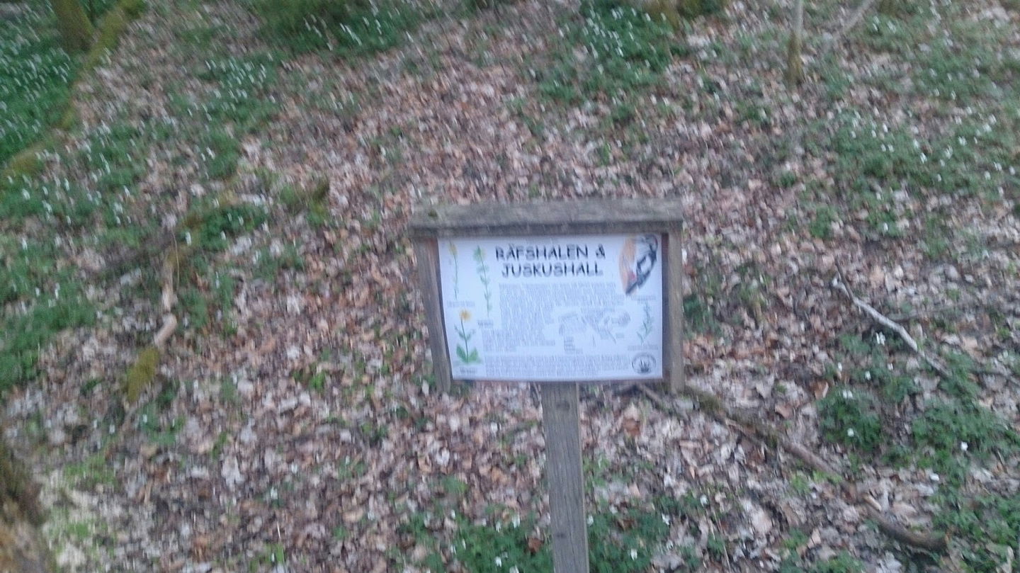
On a clear autumn day, the view from the adjacent old volcano Juskushall is breathtaking. It looks out over moss fields and surrounding pebble ridges, all in a sea of autumn colors.
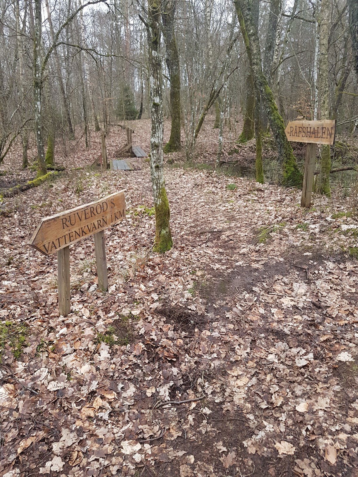
Hike the trail between Räfshalen and Ruveröd, about 1.5 km. Juskushall is passed on the way and chance to go up to the pulpit at the top.
More informationRäfshalen - Naturskyddsföreningen i Skåne (naturskyddsforeningen.se)
More informationRäfshalen - Rönneådalen - Skånes Nordvästpassage (skanes-nordvastpassage.se)
 Arvokas luonto
 Nära parkering
Follow the road from Riseberga church towards Perstorp. When you have passed Bandsjön and a large brown wooden house on the left (just over 1 km from Riseberga), after another 500 meters you come to a crossing road. About ten meters after this "four-way intersection", a small dirt road goes down to the left. There is a sign showing how to walk to Räfshalen and further towards Ruveröd's mill.
If you want to continue to Juskushall, follow the path to the left outside the fence. Once at Juskushall you will see a sign for Ruveröd.
If you come from road 108 between Spången and Hyllstofta, turn off towards Värgapet east. Drive about 1 km, you see Östra Sorrödssjön on the left and after another 500 meters you drive over Ybbarpsån and immediately turn right after the river. You are now at Ruveröds kvarn. Park your car here and go back over the bridge and turn left and follow the forest road straight ahead as described on the sign.
GPS coordinates
Decimal: 56.0847, 13.3074
Destination Rönne å och Ringsjön
![]()
Huomaa, että osa näistä teksteistä on käännetty automaattisesti.
Esitä kysymys muille Naturkartan-käyttäjille.
