

-
-

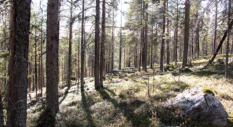
Hästkullen.
Kuva: Länsstyrelsen Norrbotten

Hästkullen
Luonnonsuojelualue
- Kunta: Norrbottens län
- 7576.9 km päässä sinusta
Toiminnot
Kuvaus
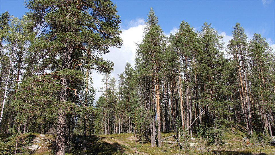
This is an easily hiked area of primary forest, right next to the large nature reserve of Serri. At the road the road there is a wind shelter and a hearth. Hästkullen comprises the mountain Oarjep Sierroajvve, over 400 metres high, in the west, and the moors southeast of the mountain, as far as the foot of Hästkullen and its steeper west side. The primary pine forest on dry brush and lichen moors is a trademark of Hästkullen. One characteristic species in the area is the long-horned beetle nothorhina muricata, whose larvae live in the bark on the south side of living, primary pines. This species is red listed and relatively rare, but traces of it have been discovered in a number of ancient pines in the reserve. The area is 3 square kilometres in size.
Toimintaa ja tilat
-
Luonnonsuojelualue
Faktat
Municipality: Jokkmokk
Year of formation: 2012
Size: 3.1 square kilometers
Administrator: County Administrative Board
Form of protection: Nature reserve
Pysäköinti
There is small, gravelled car park in the southeastern part of the reserve.
Viestintä
Hästkullen lies about 15 kilometres northwest of Jokkmokk, right next to Serri. It is signposted to Serri from the E45. At the first interpretive board for Serri there is a board for Hästkullen on the opposite side, at a gravelled car park. A small logging road also enters the northern part, leading up to Oarjep Sierroajvve mountain. The County Administrative Board does not maintain this road and you drive on it at your own risk.
Reittiohjeet
Hästkullen is located about 15 kilometers northeast of Jokkmokk. The reserve is located on the east side of the Lule River, right next to the Serri nature reserve. There are signs to Serri from road E45 north of Jokkmokk. At the first information sign to Serri on the right side of the forest road, there is an information sign for Hästkullen on the opposite side, by a gravel parking lot and fireplace. There is also a smaller forest road in the northern part of Hästkullen. It leads up towards the mountain Oarjep Sierroajvve. The County Administrative Board does not maintain this road and driving is at your own risk.
Asetukset
All regulations can be found in the reserve decision. It is allowed to:
- hike
- camping
- make a small fire
- picking berries and edible mushrooms
- drive snowmobiles on well-snow-covered ground
- fishing and hunting in accordance with applicable laws
It is not allowed to harm plant and animal life. Remember the right of public access and protect nature!
Ota yhteyttä
Sähköpostiosoite
Länsstyrelsen Norrbotten
Organisaation logotyyppi
![]()
Huomaa, että osa näistä teksteistä on käännetty automaattisesti.
Kysymykset & vastaukset (Q&A)
Esitä kysymys muille Naturkartan-käyttäjille.
Arvostelut
Sinua saattaisi kiinnostaa myös
