
-
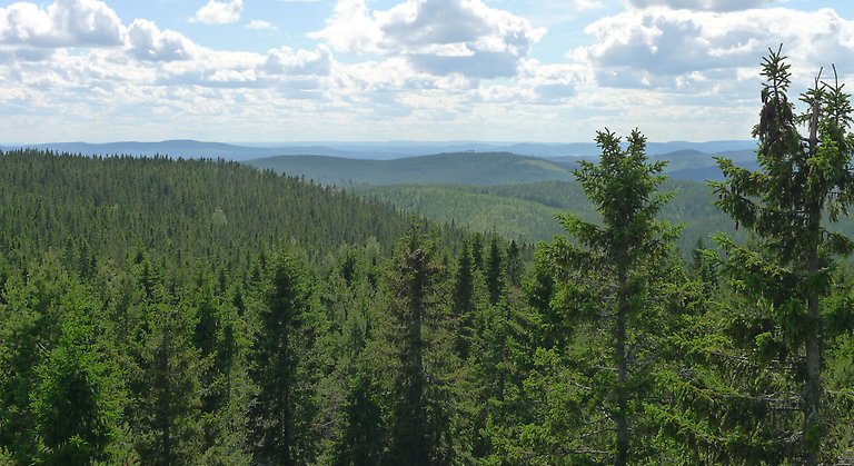
I området kan du promenera på Sjuvallsleden som går nedanför berget eller gå en slinga in genom reservatet. Berget, skogarna och de öppna myrmarkerna bjuder på spännande naturupplevelser. Foto Länsstyrelsen Gävleborg
Stora Öråsen, Naturreservat
- Naturschutzgebiet
- Landkreis: Gävleborgs län
Aktionen
Beschreibung
Stora Öråsen rises 458 meters above sea level and is the highest mountain in the area southwest of Hudiksvall. In the area you can walk on the Sjuvallsleden trail that runs below the mountain or walk a loop through the reserve. The mountain, forests and open moorland offer exciting nature experiences. The area consists of 51 hectares, of which 48 hectares are land and 3 hectares are moorland. The mountain consists of a plateau with a steep slope to the west. On the flatter sides there are also some bogs.
The forest on the plateau consists of 100-year-old, late-growing spruces. There are plenty of hanging lichens here, including the violet-grey thorn lichen. The rare and red-listed long-bearded lichen has one of its few habitats in the county here.
In addition to spruce, aspen, willow and rowan grow on the steep north-western slope. There are also plenty of hanging lichens here, and the endangered scented tick has also been found.
Aktivitäten und Einrichtungen
- Naturschutzgebiet
Fakten
Areal: 51 hektar
Skyddsår: 2005
Kommun: Hudiksvall
Förvaltare: Länsstyrelsen
Karaktär: Skog och myr
Wegbeschreibung
Das Naturschutzgebiet liegt 6,5 Kilometer südlich von Svedja in der Gemeinde Hudiksvall.
Verordnungen
Special rules apply within the nature reserve. It is not allowed to:
- drive a motorized vehicle, except for moose tractors needed to transport moose out of the area for moose hunting
- take firewood
- damage, pick or collect plants, animals (including insects), fungi and lichens
- climbing trees, staying near a bird of prey's nest, lair or pot, collecting insects or otherwise deliberately harming or disturbing wildlife, with the exception of hunting that may be carried out in the reserve
- break branches, fell or otherwise damage living or dead trees and shrubs, or do other damage to living or dead trees and plants
- bring an unleashed dog or other unleashed pet
- put up a picture, poster, billboard, sign or make an inscription
- damaging any fixed object or surface formation, such as moving or removing stones
- riding a horse or bicycle off-road
- using recorded sound in a disruptive way, or using it to attract birds or other animals.
For full regulations, see the reserve decision.
Kontakt
E-Mail-Adresse
Bitte beachte, dass einige dieser Texte automatisch übersetzt worden sind.
Ich bin hier gewesen 2


Ich möchte hierher gehen
Fragen & Antworten
Stellen Sie eine Frage an andere Naturkartan-Nutzer.
Bewertungen
0 Rezensionen
- 5 :
- 4 :
- 3 :
- 2 :
- 1 :
Bilder von Nutzern
Es gibt noch keine Nutzerbilder. Sei der Erste, der eines teilt!
