
-
Börje Eriksson -
-
Jägernåsen
- Rezerwat przyrody
- Przewodnik: Katrineholms kommun
Akcje
Opis
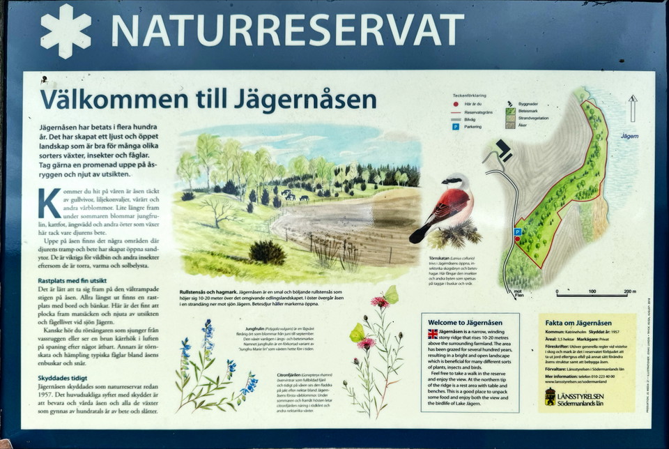
Jägernåsen Nature Reserve is ideal for walks and picnics, with easy terrain and a picnic area on the ridge offering beautiful views. The reserve consists of a narrow and rolling ridge covered with birch trees, occasional pine trees and a, where grazing animals walk freely. Long-term grazing has given rise to a rich flora with species such as maidenhair fern, cat's-foot, meadowsweet and buckwheat, while old birch trees with woodpecker holes add to the charm of the area. Maps from the 18th century show that the ridge was already used as meadow and pasture land.
To the east, the ridge becomes a narrow meadow by Lake Jägern, where birdwatchers can see brown harriers and black-necked grebes, as well as resting ducks and waders. On the ridge, animal trampling and grazing have created open sandy areas that are valuable for insects, especially wild bees, which nest in the sand and collect pollen and nectar from the flower-rich soil. This combination of sunny, sandy areas and flowering meadows makes the reserve an important habitat for many insect species.
Działania i udogodnienia
- Rezerwat przyrody
Fakty
Lata bezpieczeństwa: * * 1957
- Areal: * * 3,5 ha
- Areal: * * 3,5 ha
- Charakter: * * Sos kołowy, hagmark
- Charakter: * * Sos kołowy, hagmark
- Gmina: * * Katrineholm
- Gmina: * * Katrineholm
- Administrator: * * County Administrative Board
- Administrator: * * County Administrative Board
- Obszar ochrony * *: Rezerwa przyrody
- Obszar ochrony * *: Rezerwa przyrody
Wskazówki dojazdu
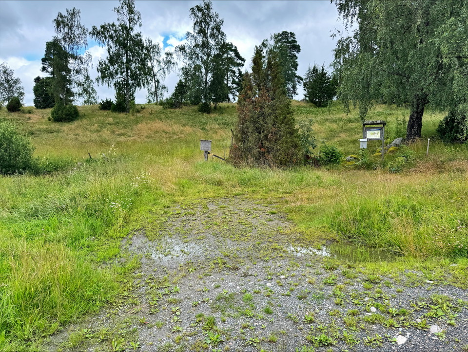
The reserve is located by Lake Jägern, near the farm Sörtorp, west of Floda church. From the road between Sköldinge and Bie, turn off at the sign for Sörtorp and "Naturreservat". There is a small, simple parking lot
Read more at Länsstyrelsen Södermanland website
Regulamin
Zabrania się:
Wyjąć glebę lub żwir lub inaczej zmienić strukturę osła
Budowanie osła
Kontakt
Adres
Kontakta kommunikationsavdelningen om du har frågor om Katrineholms naturkarta.
Vill du felanmäla något som du har upptäckt i naturen? Gör din anmälan i vår app Felanmälan Katrineholm som du hittar i din appbutik, eller via www.katrineholm.se/felanmalan
Adres e-mail
Kommunikationsavdelningen
Logotyp organizacji

Należy pamiętać, że niektóre z tych tekstów zostały przetłumaczone automatycznie.
Byłam tu 2
Chcę tu iść 3

Pytania i Odpowiedzi
Zadaj pytanie innym użytkownikom Naturkartan.
Opinie
0 reviews
- 5 :
- 4 :
- 3 :
- 2 :
- 1 :
Zdjęcia użytkowników
Nie ma jeszcze żadnych zdjęć użytkowników. Bądź pierwszym, który je udostępni!
