-
-
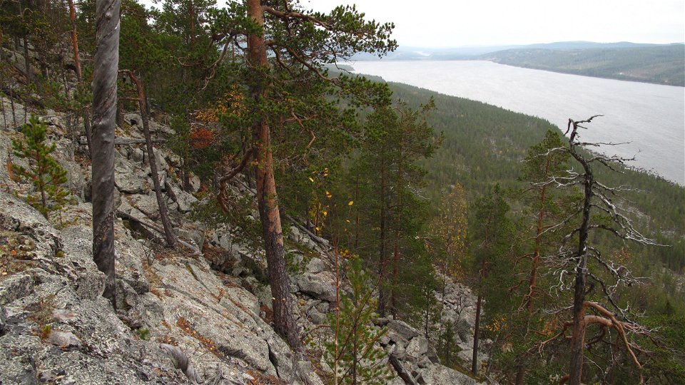
Utsikt över Stora Luleälv från Njietjagårsså naturreservat.
Foto: Länsstyrelsen Norrbotten -

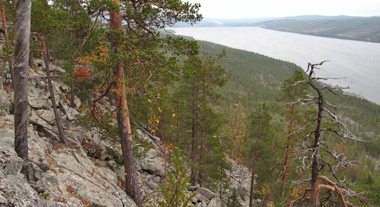
Utsikt över Stora Luleälv från Njietjagårsså naturreservat.
Foto: Länsstyrelsen Norrbotten


Njietjagårsså
Natuurgebied
- Regio: Norrbottens län
- 7585.93 km van u vandaan
Acties
Omschrijving
This is an area with old-growth forest and a nice view over the river below, but the terrain is difficult to walk in and there are very steep boulders and slopes. Above the slopes, the terrain is mostly flat.
Activiteiten en faciliteiten
-
Natuurgebied
Feiten
Municipality: Jokkmokk
Year formed: 2020
Size: 10.7 square kilometers
Trustee: County Administrative Board of Norrbotten
Type of protection: Nature reserve
Communicatie
There is no road all the way to Njietjagårsså. From Jokkmokk you take the road towards Nattavaara. North of Messaure power station you turn the second to the left to Sarkavare. From here there is a trail to Muddus/Muttos, that reaches Njietjagårsså after three kilometres.
Routebeschrijving
The most suitable access to the reserve from a public road is via the road between Jokkmokk and Nattavaara. The reserve is located midway between the two towns and north of the Messaure power plant. On the way to Nattavaara, the reserve is on the left side of the road after passing the power plant. The first exit along the private road is blocked. If you take the second exit to the left, you will reach the village of Sarkavare where the Muddus Trail begins. This means a walk of about 3 kilometers before you reach the Njietjagårssås border.
Regelingen
All regulations can be found in the reserve decision. It is allowed to:
- camping
- hiking
- picking berries and edible mushrooms
- make a fire, remember to bring your own firewood
- drive snowmobiles on well-snow-covered ground
- fish and hunt in accordance with the laws in force.
It is not allowed to dig up or pick the orchids. Remember to respect the right of public access and protect nature.
Contact
E-mailadres
Länsstyrelsen Norrbotten
Organisatie-logotype
![]()
Houd er rekening mee dat sommige teksten automatisch zijn vertaald.
Vragen en antwoorden
Stel een vraag aan andere Naturkartan gebruikers.
