


Vandringsled, informationsstig, Lappland
- Fotturer
- Fylke: Västmanlands län
- 6697.95 km fra deg
Detaljer om stien
- Lengde 5.2 km
- Vanskelighetsgrad Rød – krevende
Handlinger
Beskrivelse
Aktiviteter og fasiliteter
- Fotturer
Underlag
In places the path follows a track that can be very wet in some parts. At several of the wet parts there are footbridges. At the bog island, the path ends and you follow a marked loop instead. The loop markings are on the trees.
Bakker
The trail crosses marshland and climbs a bog hill.
Vegetasjon
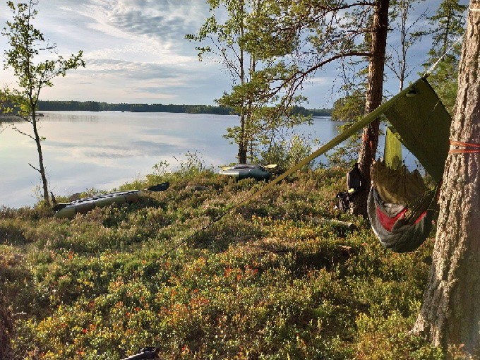
Part of the trail follows a path. Large parts of the trail go through pathless landscape. The ground is somewhat stony and there are lingonberry and blueberry bushes growing.
Kontakt
Adresse
Kontakta mig om du har frågor om Naturkartan Västmanland.
E-postadresse
Daniel Anundi
Organisasjonens logotype
Jeg har vært her 7

Jeg ønsker å dra hit 8

Omtaler
—
1 anmeldelse
- 5 :
- 4 :
- 3 :
- 2 :
- 1 :
Spørsmål og svar
Still et spørsmål til andre brukere av Naturkartan.
Brukernes bilder
Del bildene dine fra stedet!

Underbart naturreservat. Tog sikte på en avsides tjärn som till synes såg ut att ligga naturskönt. Döm om min förvåning när jag möttes av en nydragen led och nybyggt vindskydd och grillplats. Bra jobbat. 🙂