
-

Mörrumsån vid Vångaströmmarna.
Foto: Elisabet Wallsten/Länsstyrelsen -
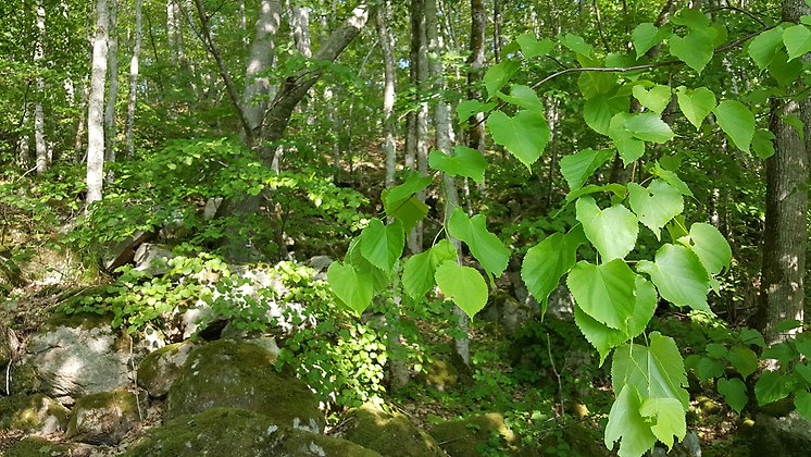
Foto: Elisabet Wallsten/Länsstyrelsen
Mörrumsåns övre dalgång, Naturreservat
- Naturreservat
- Fylke: Blekinge län
Handlinger
Beskrivelse
Aktiviteter og fasiliteter
- Naturreservat
Fakta
Year of protection: 2020
Municipality: Karlshamn and Olofström
Character: Rift valley landscape, river valley, Mörrumsån, deciduous forest, mixed forest, riverside, outdoor life, cultural history
Area: 39 ha, of which 32.6 ha is land and 6.4 ha water
Landowners: Private, company, municipality
Manager: Blekinge County Administrative Board
Form of protection: Nature reserve and partly Natura 2000
Veibeskrivelse
The nature reserve stretches from Hovmansbygd north to the Blekinge-Kronoberg county border. By bicycle, it is about 26 kilometers along the Southeast Trail on the old embankment north from Karlshamn. By car, drive county road 126 north from Karlshamn towards Ryd. Turn right onto Hovmansbygdsvägen (road 591) towards Ebbemåla/Hovmansbygd. Drive past Ebbamåla mill and further over Mörrumsån to Hovmansbygd. Turn right onto a smaller road at the reserve parking sign and follow the road south to its end, where the reserve parking lot is located.The nearest bus stop is in Fridafors, just over two kilometers north of the nature reserve Mörrumsåns upper valley's northern border, and in Hemsjö, just under five kilometers south of the nature reserve's southern border.
Forskrifter
You are welcome to visit the upper valley of Mörrumsån, but please note that it is not allowed to
- relocate or remove soil or stone, drill, hack, blast, carve, dig, paint or otherwise damage rock, soil or stone, on land or in water
- pan for gold or other minerals
- damaging stone walls, cairns or other cultural and historical remains, deliberately harming or disturbing wildlife
- capture or collect plants, fungi or animals in such a way as to damage or destroy their biotopes or reproductive habitats
- damage living or dead, standing or lying trees and shrubs, remove or burn dead wood
- digging up or pulling up plants
- pick mosses, lichens or wood-living fungi, other than what is reasonably necessary for species identification. However, edible mushrooms may be picked for personal use, provided they are not protected
- planting, sowing or spreading plants, animals, fungi or other organisms
- drive motor vehicles other than on roads reserved for motorized traffic
- ride horses or bicycles other than on existing roads and paths
- camping or otherwise setting up camp for more than 2 days. On hay meadows, it is completely forbidden to camp or otherwise set up camp before the meadow is mown
- set up a motorhome, caravan, trailer or equivalent other than in a designated parking lot and there for a maximum of 1 day
- light fires or use barbecues, other than in specially designated barbecue areas
- moor or moor a boat or other watercraft for more than 1 day.
Without permission from the county administrative board, you may not
- carry out scientific surveys involving sampling, marking, trapping, installation of equipment or any form of impact on plant or animal life. Collecting by destructive methods, such as destroying substrates, is prohibited
- using the area for competitions, exercises, events or other organized activities that may disturb nature or the public's outdoor life
- put up a board, poster, poster, sign, signpost, trail marking, inscription or comparable device, other than temporarily (maximum 1 week) in connection with hunting or in connection with organized outdoor activities.
Kontakt
E-postadresse
Länsstyrelsen Blekinge
Organisasjonens logotype
Jeg har vært her 1

Jeg ønsker å dra hit 2
Spørsmål og svar
Still et spørsmål til andre brukere av Naturkartan.
Omtaler
0 anmeldelser
- 5 :
- 4 :
- 3 :
- 2 :
- 1 :
Brukernes bilder
Ingen brukerbilder ennå. Bli den første til å dele!
