
Röd led Östra Kullaberg
- Fotturer
- Fylke: Skåne län
- 6719.35 km fra deg
Detaljer om stien
- Lengde 5.5 km
Handlinger
Beskrivelse
Aktiviteter og fasiliteter
- Fotturer
Fakta
Marshes, villages and fishing village
This stage of the Red Trail runs from Mölle (Aldal) at the entrance to Västra Kullaberg, east past Mölle bog and Björkeröd, on via Himmelstorpsgården and Strandhagen and ends in Arild harbor - about 5.5 km one way, or 1.5-4 hours depending on breaks and detours. The trail is predominantly easy and suitable for families.
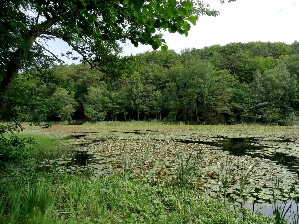
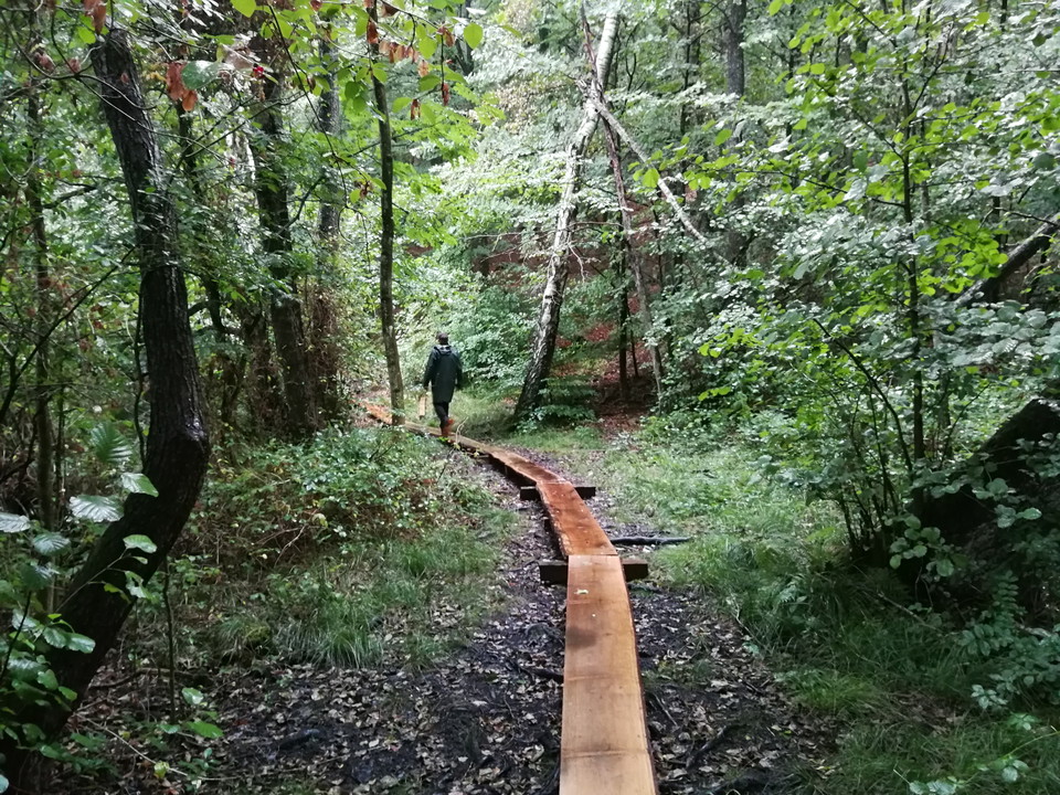
Early on the trail you will meet Mölle mosse, an idyllic wetland in the forest that in summer is dotted with yellow water lilies, white, and red. The red water lily is a color variant of the white one, which was discovered in a lake in Närke in the 19th century and later spread by planting. In spring, you can stand on the shore and watch the lesser newt spawning in the shallow water - the male is recognized by its wavy dorsal crest. Both species are protected, as are all frogs, toads and snakes. Sometimes the snake glides by with its yellow spots on the back of its head - it is completely harmless. Along the shore grow belts of water clover with hyacinth-like inflorescences, missne with white bracts and poisonous red berries, and broom sweet with small purple flowers and a yellow center. The path around the bog is partly boarded on the south side.
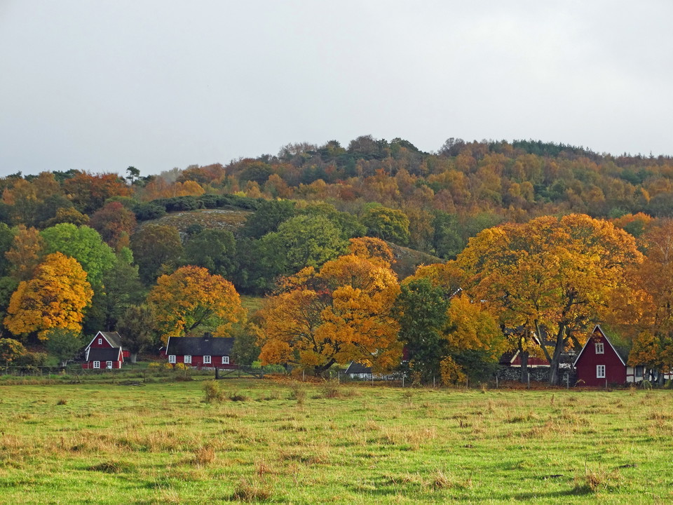
Further east you reach Björkeröd, a picturesque village dating back to the 14th century and is one of the places on Kullaberg where the cultural-historical landscape remains. At Björkeröd there is parking and a rest area with coffee tables, barbecue and toilet - a natural break on the way. Björkeröd's bog next to the village is a rich bird habitat with, among other things, mallard, coot, grey partridge, grebe, lapwing, brown duck and heron, and in the spring, resting ringed thrush can be seen in the fields around the wetland. If you take a short detour east through the village and north up the red trail, you will arrive at Enebacken - a fantastic place for a coffee break and a good observation spot for birds of prey.
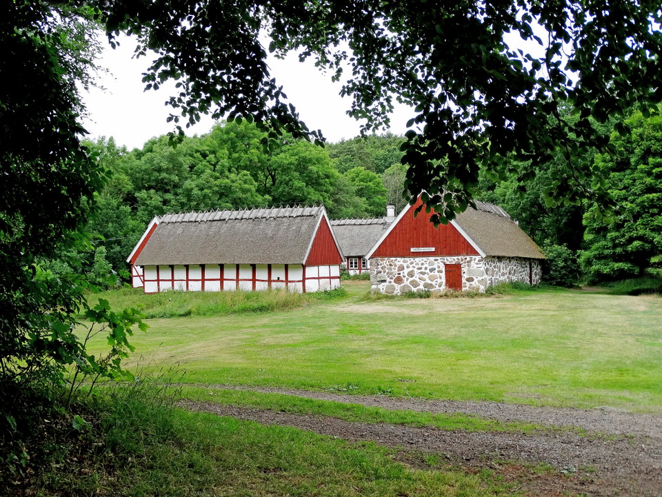
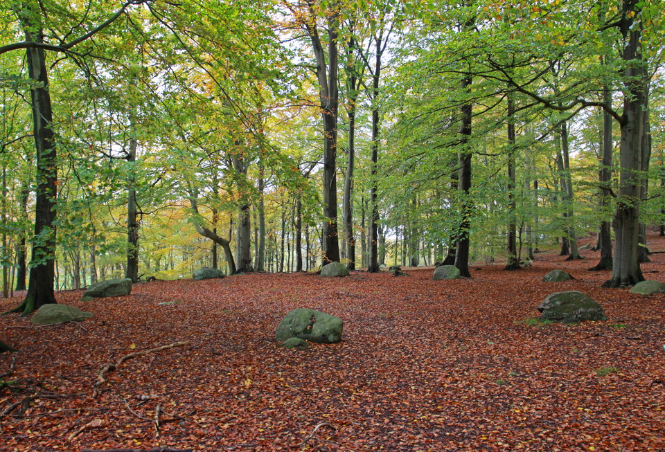
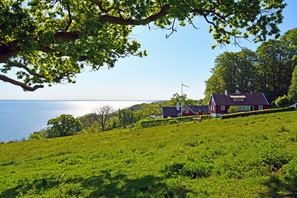
Just after Björkeröd is Himmelstorp's homestead, a four-length half-timbered farm dating back to the 15th century and today a listed building. The farm was used under the Krapperup estate until the mid-20th century and is today managed by Kullens Hembygdsförening. A short walk south from Himmelstorpgården you'll find the highest judge's ring. And below the parking lot there are two Iron Age stone circles. All the stone circles have nine mighty lump stones - evidence of a burial site far older than the farm itself. Carl Linnaeus described the site on his visit in 1749.
Further east, the trail passes Bergahusen, also known as Ladarp, a collection of crofts with an unusually well-preserved history. The site was abandoned during the plague of 1710-1711 but was rebuilt in the latter half of the 18th century, when crofters who lived wholly or partly on fishing and shipping moved in. Three of the crofts remain today - two became summer houses already around the turn of the century 1900, while the third was used until the 1950s. The old fence alongside the houses once marked the boundaries of Björkeröd, Himmelstorp and Haga.
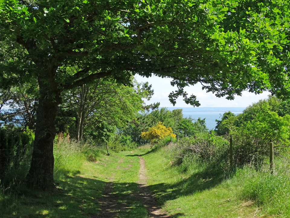
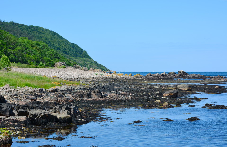
The trail ends at Arild, but just before that you pass Strandhagen Nature Reserve - an open flat area with shingle fields alternating with herb-rich vegetation, a remnant of the cultural landscape that once stretched along the entire coastal strip of the Kullen. Closest to the sea are saltwater-affected coastal meadows with yellow campion, sea holly and sea aster, and a bit up a lime-affected dry meadow with scrub violet, maidenhair fern, bream and chickweed. Several butterfly species thrive here, among them the six-spotted bastard swallowtail and the firefly. It is at Strandhagen and further towards Haga and Arild that the extensive views open up - over Skälderviken, the Bjäre Peninsula, Hovs Hallar and Hallands Väderö in the distance.
The trail ends in Arild, one of the oldest fishing villages on the Kulla Peninsula, first mentioned in a papal letter in 1475 and named after the legend of St. Arild. The village's terraced streets, winding fishermen's lanes and Skåne's only medieval fish camp chapel. Arlid has attracted artists since the 1850s - including Prince Eugen and P.S. Kröyer.
Östra Kullaberg is a nature reserve with special rules to protect nature. You can only light fires at fixed barbecue areas, dogs must be kept on a leash all year round and camping is not allowed. Mountain biking is allowed, but only on the designated MTB trail. Access to the bird protection areas along the north coast is prohibited from March 1 to July 15, so that peregrine falcons can nest in peace. Steep cliffs occur on detours to the north side - keep your distance and supervise children and dogs. Bring water, food and time, and leave nature as you found it.
Veibeskrivelse
Walk, cycle, take public transport or drive here. On the map, you can click on a parking lot or access point. For directions, click on the 'Find here' arrow (below the map).
Forskrifter
**Kullaberg consists of two nature reserves, Västra and Östra Kullaberg. Kullaberg has very high natural values that we want to protect, so special rules apply here and only parts of the right of public access apply.
Here it is forbidden, among other things, to:
- make fires anywhere other than in our barbecue areas
- camping anywhere other than at our campsite at the lighthouse parking lot
- having a dog unleashed
- disturbing wildlife
- picking or digging up flowers
- stay or drive a boat during the period March 1 to July 15 within the marked areas in the map appendices for Västra and Östra Kullaberg.
[All regulations (rules) can be found here (https://www.lansstyrelsen.se/skane/besoksmal/naturreservat/hoganas/kullaberg.html?sv.target=12.382c024b1800285d5863a89a&sv.12.382c024b1800285d5863a89a.route=/&searchString=&counties=&municipalities=&reserveTypes=&natureTypes=&accessibility=&facilities=&sort=none)
Kontakt
Adresse
Under LÄNKAR kommer du till aktuell reservatssida på Länsstyrelsens webbplats, med fördjupande information som kartor, broschyrer och hänvisning till relevanta aktörer. Här finns även en rapportfunktion för dig som vill lämna uppgifter om naturreservaten som vi förvaltar.
E-postadresse
Organisasjonens logotype
Jeg har vært her 4

Jeg ønsker å dra hit 2
Omtaler
—
0 anmeldelser
- 5 :
- 4 :
- 3 :
- 2 :
- 1 :
Spørsmål og svar
Still et spørsmål til andre brukere av Naturkartan.
Brukernes bilder
Del bildene dine fra stedet!
