
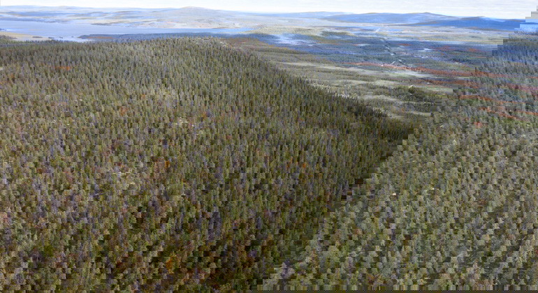
Stor-Getarberget
- Naturreservat
- Fylke: Norrbottens län
Handlinger
Beskrivelse
Discover a spruce forest with a natural structure and the rare geological formation known as rösberg. The forest in the reserve looks like an old spruce forest should when it has not been affected by modern forestry: it is sparse and features trees of various sizes and ages.
In the western part of the reserve, you can see what an ancient spruce forest truly looks like without the influence of logging. Here, you can experience how open and sparse an old forest can be and observe the amount of dead wood that forms when the forest is allowed to develop freely over a long period. On the old spruces, you can find boundary lichen and knotted blue lichen, both of which depend on continuity forests—areas that have been forested for a long time without interruption.
In the eastern part of the reserve lies Stor-Getarberget, the highest peak in the area at 670 meters above sea level. The mountain has an intriguing geological history. During the last ice-free period around 75,000 years ago, large areas of frost-shattered rock, known as rösberg, were formed around the summit of the mountain.
Aktiviteter og fasiliteter
- Naturreservat
Veibeskrivelse
The nature reserve is located 3 km south of Lake Storavan in Arvidsjaur Municipality. Directly south of the reserve, the neighboring natural forest continues into Sveaskog's eco-park Ledfat. There are several possible access routes to the reserve, but none that lead all the way to the area. The most suitable access routes are from the east, via forest roads from county road 619. The condition of the roads is unknown, and there is no agreement regulating public use of these roads.
Forskrifter
It is
allowed to:
- Camp
- Hike
- Pick
berries and edible mushrooms
- Make a
fire (remember to bring your own firewood!)
- Ride
snowmobiles on well-covered snow
- Fish and
hunt in accordance with applicable laws
It is not
permitted to harm plant and animal life. Remember to respect the right of
public access and take care of nature!
Kontakt
E-postadresse
Länsstyrelsen Norrbotten
Organisasjonens logotype

Jeg har vært her
Jeg ønsker å dra hit
Spørsmål og svar
Still et spørsmål til andre brukere av Naturkartan.
Omtaler
0 anmeldelser
- 5 :
- 4 :
- 3 :
- 2 :
- 1 :
Brukernes bilder
Ingen brukerbilder ennå. Bli den første til å dele!
