Beste turstier i Sölvesborg

Sölvesborg

Naturkarten samler de turstiene i Sölvesborg som er mest populære blant våre brukere.

Bilder

Kart

45 Beste turstier i Sölvesborg

Fotturer

01 Sölvesborg - Grundsjön | Blekingeleden

  • Kommune: Sölvesborg
  • 6840.25 km fra deg
  • 14.2 km
  • Vanskelighetsgrad: Grønn

The Blekingeleden Trail runs from the edge of the sea in Sölvesborg deep into the beechwoods on the ridges of Ryssberget with fantastic views over the drained lake Vesan to the east. Walk along pleasant forested paths as the light filters through the leaves…
Fotturer

Vandringsrunda Listershuvud röd, gul, vit och blå led

  • Kommune: Sölvesborg
  • 6855.07 km fra deg
  • 8.2 km

Listershuvud is Blekinge's largest nature reserve to the surface and consists of a 450-hectare area in the eastern part of Listerlandet. The nature reserve is located south of Hörvik and north of Nogersund. There are three recommended car parks for the natu…

Fotturer

Vit slinga

  • Kommune: Sölvesborg
  • 6860.31 km fra deg
  • 4.3 km

On Hanö there is one of Blekinge's largest hornbeam forests and the atmosphere in this is almost magical as the moss lies like a blanket over rocks and paths with ferns that grow a little here and there. Other parts of the island's overgrown parts are made…

Fotturer

Vandringsrunda Stiby Backe, röd och vit led

  • Kommune: Sölvesborg
  • 6851.80 km fra deg
  • 3.4 km

Stiby hill is located next to Hällevik in Listerlandet and has an area of ​​110 hectares. In the southwest, the reserve adjoins the Listerlandet cycle path. There are three car parks to start from. The northern parking lot for the reserve is located approxi…

Fotturer

Grundsjön

  • Kommune: Sölvesborg
  • 15.87 km

Trail between Grundsjön - Östafors. Varying terrain. More than 50% on nature trail.

Fotturer

Ryssberget blå och vit vandringsrunda

  • Kommune: Sölvesborg
  • 6844.23 km fra deg

Hike or run in beautiful beech forest on a varied surface of nature trails and forest roads with undulating forest terrain. There are many paths and roads on Ryssberget in and outside the nature reserve where the recreational value is high. In addition to t…

Fotturer

Ryssberget Vita led

  • Kommune: Sölvesborg
  • 6843.32 km fra deg
  • 2.8 km

Ryssberget's white trail is 2.8 km long. The trail is suitable for cycling and hiking in beautiful beech forest. The surface is a nature trail and forest road where some parts are hilly forest terrain. Together with part of the Blekingeleden, it can be comb…

Fotturer

Geologisk stig Hanö

  • Kommune: Sölvesborg
  • 6860.19 km fra deg
  • 2.6 km

On Hanö there are traces in the landscape that tell about the ice age and former water levels. Walk the geological trail and read about ice grooves, cobblestone fields and drumlines on signs along the way. You also get to follow the history of the Baltic Se…

Fotturer

Sölvesborgs Golfstråk

  • Kommune: Sölvesborg
  • 6845.84 km fra deg
  • 3.0 km

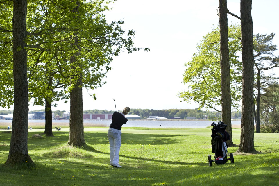
An experience even for non-golfers Regardless of whether you are a golfer or not, you now have the opportunity to enjoy one of Sweden's best golf courses up close. In the spring of 2022, Sölvesborgs Golfklubb will open a walking path that runs next to the g…

Fotturer

Slottsrundan

  • Kommune: Sölvesborg
  • 6845.10 km fra deg
  • 1.9 km

Slottsrundan is 1.9 km long and an unmarked trail that offers a cultural walk close to the city. Beautiful views of Sölvesborg Bay and the now famous Sölvesborg Bridge, a tour around the Castle Ruins and up on the hill a fantastic view of the city.

Fotturer

Barmarksled, Listershuvud

  • Kommune: Sölvesborg
  • 6855.14 km fra deg
  • 0.7 km

Längs den blåa leden kan du ta en avstickare längs stigen som har sitt namn efter alla kärleksförklaringar som finns inristade i de intilliggande träden. Listerhuvud är beläget mellan Hörvik i norr och Nogersund i söder. Naturreservatet rymmer både en slåen…

Fotturer

Listershuvud Blåa leden

  • Kommune: Sölvesborg
  • 6855.72 km fra deg
  • 2.2 km

The trail passes the top of Listershuvud in the west and the viewpoint over Hanö in the east. Listerhuvud is located between Hörvik in the north and Nogersund in the south. The nature reserve contains strikingly beautiful scenery, rich wildlife and remains…

Fotturer

Listershuvud Vita Geologisk stig

  • Kommune: Sölvesborg
  • 6855.67 km fra deg
  • 1.3 km

Stigen erbjuder olika typer av underlag och vegetation och sträcker sig från parkeringsplatsen vid Listershuvud till grillplats i öst och visar upp många intressanta geologiska fenomen. Listerhuvud är beläget mellan Hörvik i norr och Nogersund i söder. Natu…

Beste turstier i Sölvesborg

Naturkarten samler de turstiene i Sölvesborg som er mest populære blant våre brukere.

Naturkartan

Åpne dette i appen