


Pilgrimsleden Västra Värmland, etapp Arvika
- Pilegrimsrute
- Fotturer
- Gammelt monument/kulturminne
- Fylke: Värmlands län
- 6533.92 km fra deg
Detaljer om stien
- Lengde 56.0 km
- Tid 14 t
- Vanskelighetsgrad Grønn – enkel
Handlinger
Beskrivelse
Aktiviteter og fasiliteter
- Fotturer
- Gammelt monument/kulturminne
- Pilegrimsrute
Underlag
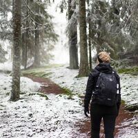
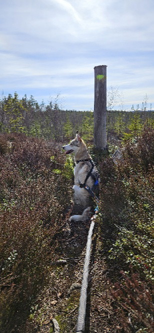
The trail passes through all types of terrain - meadows, farmland, small communities, gravel roads, asphalt roads, forest roads, forest paths and past cultural and historical landmarks. Often the surface is old marsh roads with grass in the middle, but also shingle-covered logging roads, forest trails and asphalt or gravel roads for car traffic.
Bakker
Mostly flat and easy to walk, but along some forest areas the climb can be a little steeper, for example Majsaklätten in Sölje.
Kommunikasjon
According to the pilgrim tradition, the direction of the trail is from south to north, finally reaching Nidaros/Trondheim.
Part towards Säffle municipality , long 12,782 / lat 59,406 The trail crosses the municipal boundary along a small gravel road, next to Torrgårdshöjden. The nearest public and spacious parking lot is about 2 km north of the section at Stömne nature reserve. You can also take bus 103 Arvika-Stömne. For timetables see Värmlandstrafik (varmlandstrafik.se).
If you choose to go in a southerly direction from the part towards Eda municipality, the coordinates of the starting point in Krokebol are long 12,326 / lat 59,699. Bus line 104 Arvika-Koppom-Årjäng runs past Krokebol. For timetables see the link above.
Kontakt
Adresse
Besöksadress:
Visit Arvika
Arvika Turistcenter
Storgatan 22
671 31 Arvika
www.visitarvika.se
E-postadresse
Visit Arvika
Organisasjonens logotype

Jeg har vært her
Jeg ønsker å dra hit 12




Omtaler
—
0 anmeldelser
- 5 :
- 4 :
- 3 :
- 2 :
- 1 :
Spørsmål og svar
Still et spørsmål til andre brukere av Naturkartan.
Brukernes bilder
Del bildene dine fra stedet!
